4.7
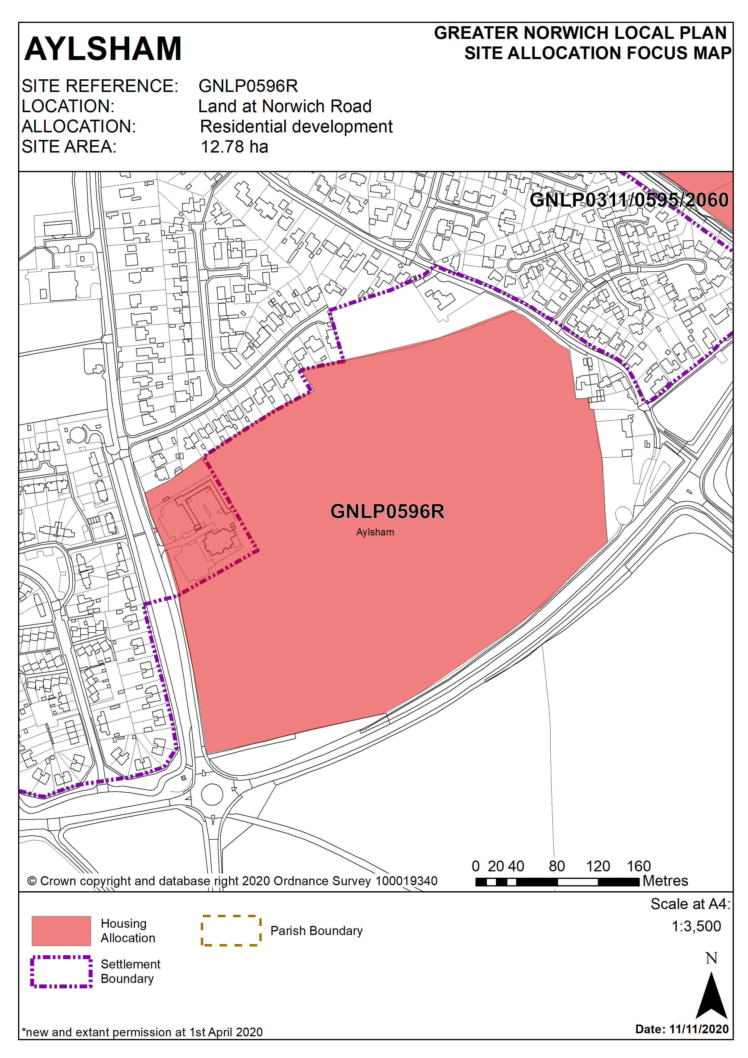
This site is to the south of the town centre and is significant in defining the ‘gateway’ to Aylsham. Both in terms of built form and transport provision. The site is located next to the main Norwich Road, A140, and B1145 roundabout serving the town.
4.8
Access into the development will be via two points of access from Norwich Road, plus providing pedestrian connectivity via Buxton Road and Copeman Road. Development offers opportunity for landscape and green infrastructure enhancements, such as screening on the south-east boundary to the A140. Early engagement with statutory consultees is always recommended, but in this case most particularly the Environment Agency and Anglian Water to agree options for foul waste disposal.
4.9
This allocation also secures land for the community’s aspiration to promote better sustainable transport. An objective that is set out in the Aylsham Neighbourhood Plan 2018-2038, and has been expressed in consultation feedback during the GNLP’s preparation. 0.25 ha is secured to be transferred at nil cost to the Town Council.
4.10
Use of the community land will be for promoting sustainable transport, with the exact outcomes to be the responsibility of the Town Council. Possibilities include, but are not limited to, ‘park & ride’, ‘park & cycle’, and ‘park & walk’, and will be for the benefit of local residents and businesses, as well as visitors and tourists to Aylsham. Surfacing, other structures, and buildings on the land are restricted to the operation of a sustainable transport ‘hub’ facility. The scheme should be delivered by 2038 or otherwise the land reverts to residential use.
Policy GNLP0596R
Land at Norwich Road, Aylsham (approx. 12.78 ha) is allocated for residential development. The site is to accommodate at least 255 homes. The mix of uses is to include a 90 bed care unit/extra care housing1, and 0.25 ha for community use to meet sustainable transport objectives.
The development will address all the following specific matters:
- Masterplan to identify the mix of uses on the site and the relationship between them, to be accompanied by a phasing and infrastructure plan.
- Transport assessment with implementation of any agreed highway mitigation measures.
- Access should be via Norwich Road with two access points for vehicles. 3.0m wide frontage footway/cycleway to connect with existing facilities and revision of speed limit, plus cycle improvements at A140/B1145/Norwich Road roundabout.
- Pedestrian and cycle access only from Buxton Road and Copeman Road. Safeguarding of existing Public Right of Way at south of site.
- 0.25 ha of land at nil value to the Town Council to meet neighbourhood plan objectives for out-of-town parking, and promotion of sustainable transport modes.
- Layout and design to take account of noise from the adjacent A140, and landscaping to screen impact on the countryside setting to the south-east.
- A drainage strategy, and completion of required mitigations, to ensure that development would not cause detriment to the capacity of the sewer system nor result in increased flood risk downstream.
- Any development should conserve and where appropriate enhance the setting of the Grade II Diggens Farmhouse to the east of the site, including any contribution made to that significance by setting.
Policy Map
Footnotes
1For calculating strategic housing requirement, a 90 bed care unit/extra care housing scheme is estimated as equivalent to 45 dwellings. An estimate based on the number of homes made vacant by a person/household moving from general accommodation into specialist accommodation. The overall housing number for GNLP0596R is estimated at 300, and with GNLP0311, 0595 and 2060, the total new housing allocated for Aylsham equals 550.