3.49
This site was allocated in the 2016 Broadland Local Plan and it is intended to carry this allocation forward, recognising a need for more burial land in the future. Site GNLP1020 seeks to maintain this allocation for burial ground use in the new local plan to 2038.
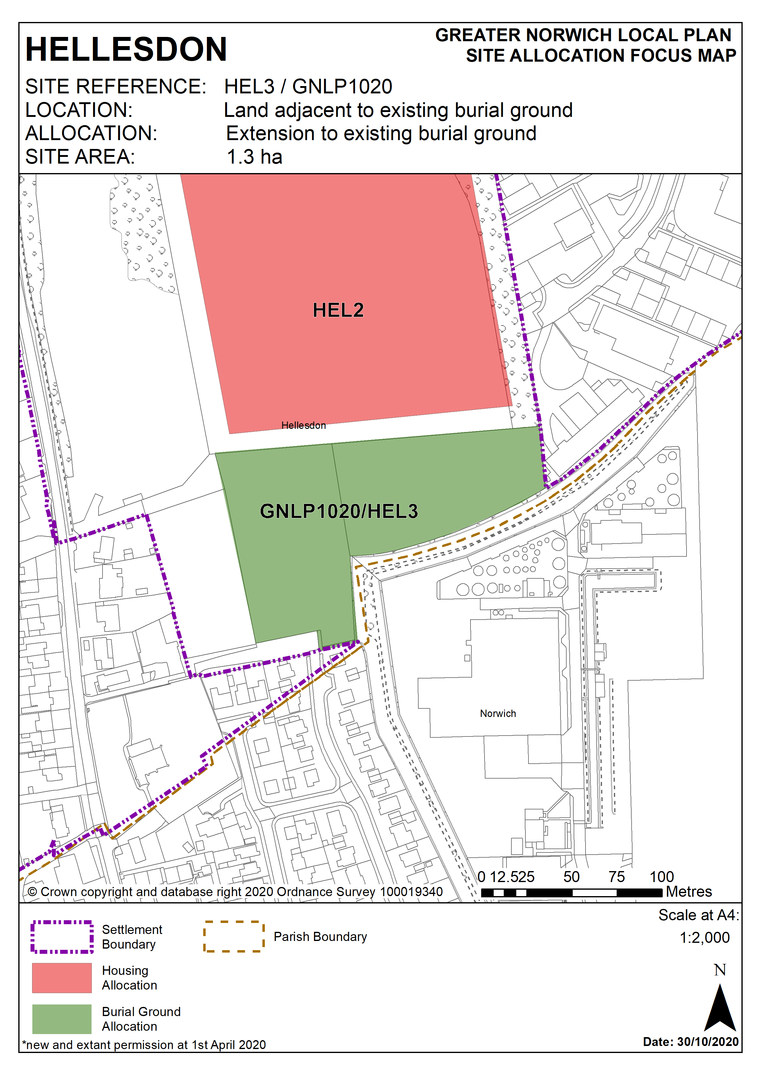
Policy HEL3/GNLP1020
Land adjacent to existing burial ground – north east of St Marys Church, Hellesdon (approx. 1.3 ha) is allocated for an extension to the existing burial ground.
The development will be expected to address the following specific matters:
- Access via the existing cemetery.
- The site falls within Source Protection Zone 3 and therefore further investigation should be undertaken to assess the potential risk to groundwater.
- The Environment Agency may seek to ensure a 250m minimum distance from potable groundwater supply source; 30m minimum distance from watercourse, spring or groundwater fed water feature; 10m minimum distance from field drains; and no burials into standing water with a minimum of 0.7m unsaturated ground below the base of the coffin.
Policy Map