3.48
This site was allocated in 2016 as part of the Broadland Local Plan but has not yet been fully developed. It is expected that the complete development will take place within the time-period of the new local plan up to 2038. The site is re-allocated for residential development and has been considered in the calculation of the housing requirement.
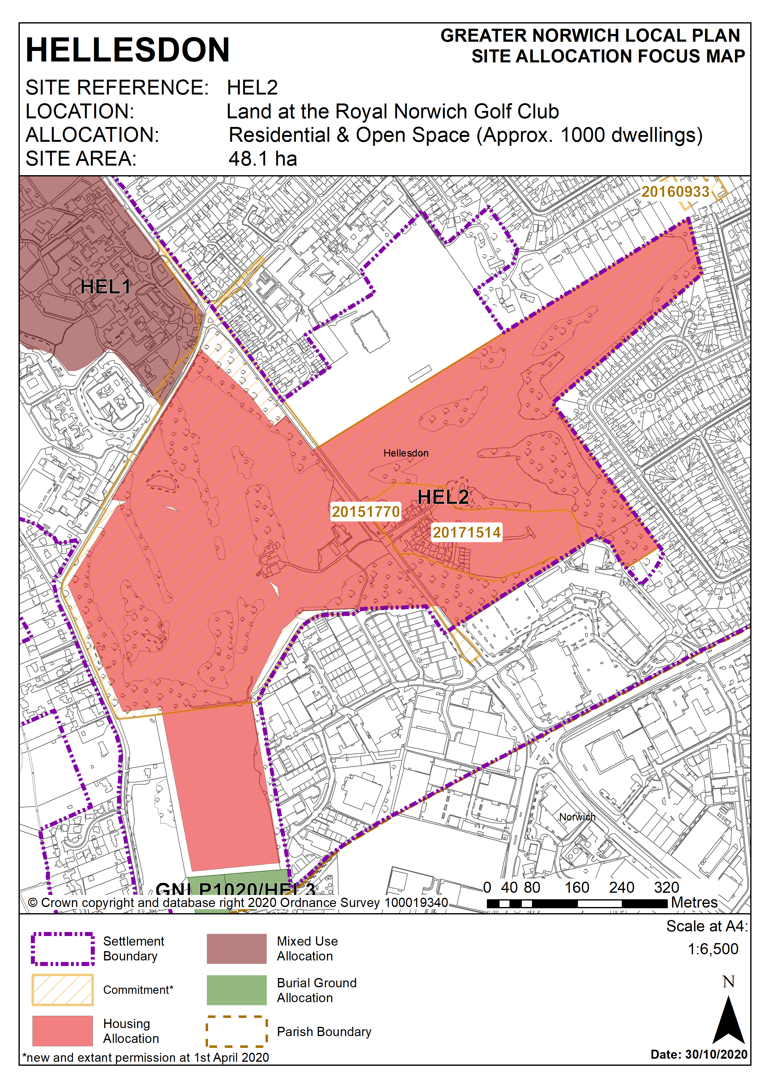
Policy HEL2
Strategic Allocation
Land at the Royal Norwich Golf Club, either side of Drayton High Road, Hellesdon (approx. 48.1 ha) is allocated for residential and open space uses. This will accommodate approximately 1,000 homes.
More homes may be accommodated, subject to an acceptable design and layout, as well as infrastructure constraints.
The development will be expected to address the following specific matters:
- Improvements may be needed to existing traffic light-controlled junction and a possible pedestrian crossing on the A1067 Drayton High Road.
- Up to 2 hectares of the site should be safeguarded for education provision, either as an expansion of the existing schools (Kinsale Infant School, Kinsale Junior School and Hellesdon High School) or land for a new primary school elsewhere within the site.
- The loss of the golf course should be mitigated by providing alternative equivalent provision elsewhere.
- The southwest corner of the site is within the HSE safeguarding zone associated with the chemical plant to the south of the site.
- The site falls within Source Protection Zone 3 and therefore pollution control techniques should be incorporated to ensure that development of the site does not lead to pollution of the water environment.
- Norfolk Minerals and Waste Core Strategy Policy CS16 applies, as this site is underlain by safeguarded minerals resources. The benefits of extracting the minerals, if feasible, will be taken into consideration.
Policy Map