5.45
This site is allocated as it is well related to the form and character of the settlement and is less constrained than other sites promoted, which raise access or townscape and heritage concerns. The allocation is subject to two points of access. The site rises to the north so development on this site would be significantly more visible in the landscape than the dwellings and units opposite, and the design of the development would need to address the issues with the topography of the site, particularly with reference to the site’s proximity to the Broads. The proximity to the Broads may also mean development impacts on nearby SSSI/Natura 2000 designated sites, which must be mitigated.
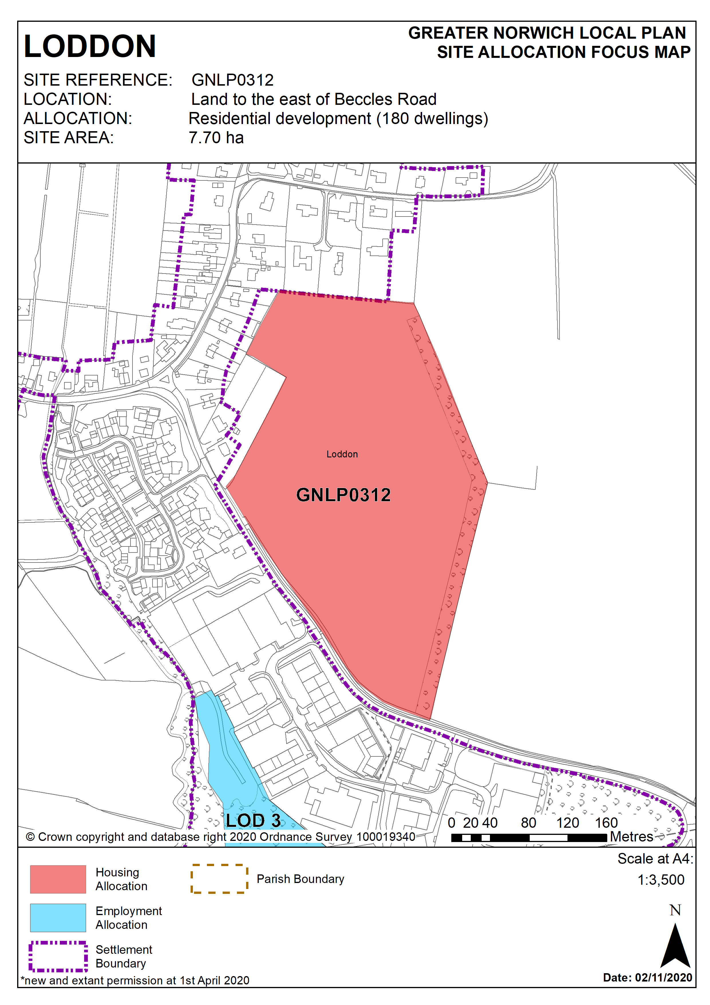
Policy GNLP0312
Land to the east of Beccles Road, Loddon (approx. 7.70 ha) is allocated for residential development. This site is likely to accommodate at least 180 homes.
More homes may be accommodated, subject to an acceptable design and layout being achieved and any infrastructure issues addressed.
The development will be expected to address the following specific matters:
- Two points of vehicular access to be provided into the site.
- Areas of surface water flooding on the Beccles Road boundary or elsewhere in the site to be addressed
- Any development must conserve and enhance the significance of listed buildings within the Loddon and Chedgrave Conservation Area to the north-west of the site, including any contribution made to that significance by setting
- Design and layout must address the topography of the site and potential impact on views, particularly to and from the Broads.
- The trees/hedgerows surrounding the site will be protected, enhanced and incorporated into the scheme.
- An ecological assessment must be carried out, and any identified impacts on nearby sites mitigated
- The design and layout of the scheme must consider amenity impacts relating to the nearby business area.
Policy Map