4.34
This site is located to the south of the town with access from Mendham Lane. A masterplan and transport assessment are necessary for the site. Amongst the considerations for the masterplan is the relationship between the different uses of development proposed and the impact on adjacent existing development, provision of vehicular accesses, pedestrian and cycle access, the connectivity of the Public Right of Way through the site, green infrastructure, and landscaping. A Transport Assessment is required also to address amongst other issues the Shotford Road junction with London Road.
4.35
Early engagement with statutory consultees is always recommended, but in this case most particularly the Environment Agency, the Lead Local Flood Authority and Anglian Water to agree options for water supply, surface water flood risk, and foul waste disposal. The importance of early and continued engagement with local residents and groups in the town is also emphasised. The purpose being to ensure the design and long-term maintenance of open space and land for community use is affectively achieved.
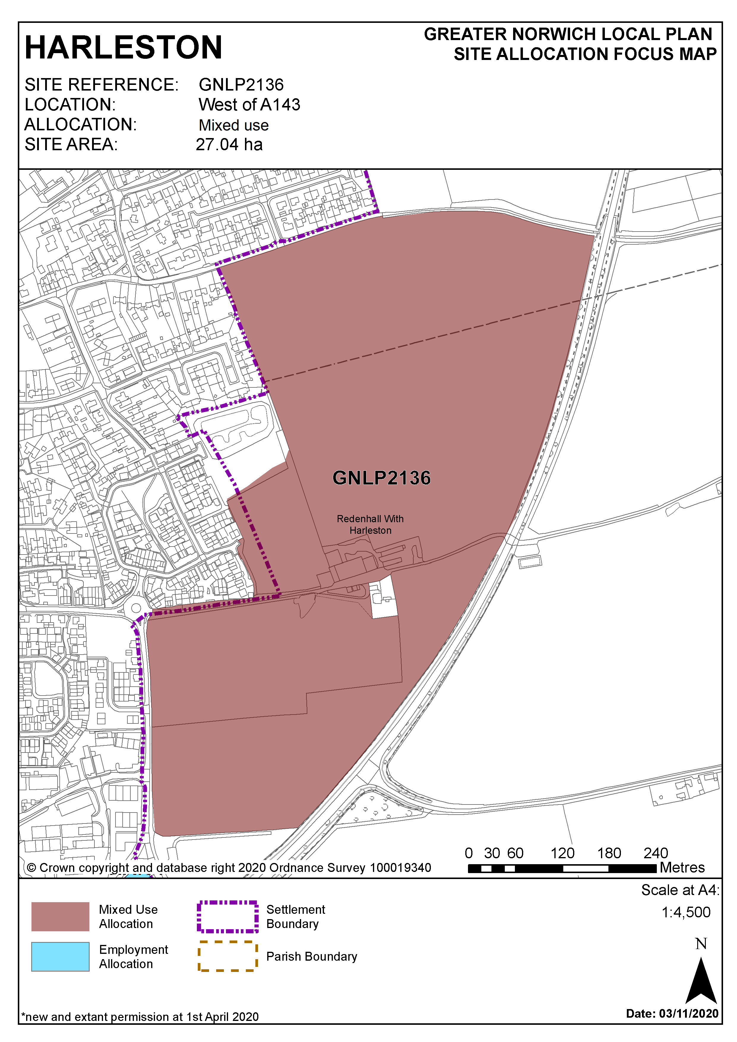
Policy GNLP2136
Land at Briar Farm, Harleston (approx. 27.04 ha) is allocated for mixed-use development. The site is likely to accommodate approximately 360 homes, of which around 60 will be single storey dwellings aimed at the active elderly. In addition to housing, the mix of uses is also to include a 90 unit extra care housing scheme3, 0.8 ha of retail or employment land, 1.6 ha for community use, allotments, and public open space.
The development will address all the following specific matters:
- Masterplan to identify the mix of uses on the site and the relationship between them, to be accompanied by a phasing and infrastructure plan.
- Transport assessment with implementation of any agreed highway mitigation measures.
- At least two points of vehicular access with 3.0m wide frontage footway/cycleway to connect with existing facilities and revision of speed limit.
- A new footpath connection to the existing Public Right of Way to the north of the site, creating a new link to the proposed open space to Angles Way.
- Safeguarding of existing Public Right of Way east of Mendham Lane.
- Design and layout to take account of the existing residential and employment development to the west, northwest and north of the site, to protect the amenity of existing and future residents.
- Layout and landscaping to take account of the River Valley location and the potential to mitigate noise from the adjacent A143.
- Contribution towards green infrastructure protection or enhancement along the Waveney valley corridor.
- Appropriate investigation works and mitigation measures to address the surface water flooding to the north east of the site will be required.
- A proportionate contribution towards a new public water supply to help meet the requirements of the development.
Policy Map
Footnotes
3For calculating strategic housing requirement, a 90 unit/extra care housing scheme is estimated as equivalent to 45 dwellings. An estimate based on the number of homes made vacant by a person/household moving from general accommodation into specialist accommodation. The overall housing number for GNLP2136 is calculated at 405, and with GNLP2108, the total housing on newly allocated sites in Harleston equals 555.