4.33
This site is located to the south of the town with access from Spirkett’s Lane. Development would require two points of vehicular access from Spirkett’s Lane with pedestrian and cycling improvements. A Transport Assessment is required also to address amongst other issues the Shotford Road junction with London Road, as well the Public Right of Way through the site to the River Waveney. Consideration will be needed to the design layout and landscaping, reflecting the River Waveney location and to recognise surrounding existing development. Early engagement with statutory consultees is always recommended, but in this case most particularly the Environment Agency, the Lead Local Flood Authority and Anglian Water to agree options for water supply, surface water flood risk, and foul waste disposal.
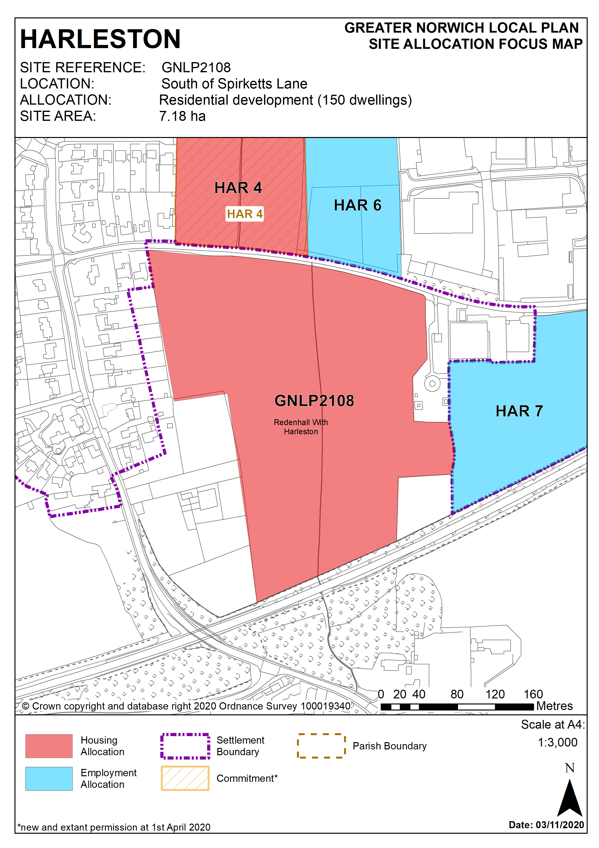
Policy GNLP2108
Land South of Spirketts Lane, Harleston 7.18 ha is allocated for residential development. The site is likely to accommodate at least 150 homes and open space.
The development will address the following specific matters:
- Two points of access (vehicular and pedestrian) to be from Spirkett's Lane with 3.0m wide frontage footway/cycleway to connect with existing facilities.
- Transport assessment with implementation of any agreed highway mitigation measures.
- Safeguarding of existing Public Right of Way (PROW) to River Waveney.
- Layout and landscaping to take account of the listed buildings to the west, River Valley location and the potential to mitigate noise from the adjacent A143.
- Contribution towards green infrastructure protection or enhancement along the Waveney valley corridor.
- Design and layout to take account of existing residential development on Spirketts Lane and Shotford Road to the north and west, and employment development/allocations to the northeast and east, to protect the amenity of existing and future residents.
- Historic Environment Service to be consulted to determine any need for archaeological surveys prior to development.
- A proportionate contribution towards a new public water supply to help meet the requirements of the development.
- A suitable drainage strategy.
Policy Map