4.39
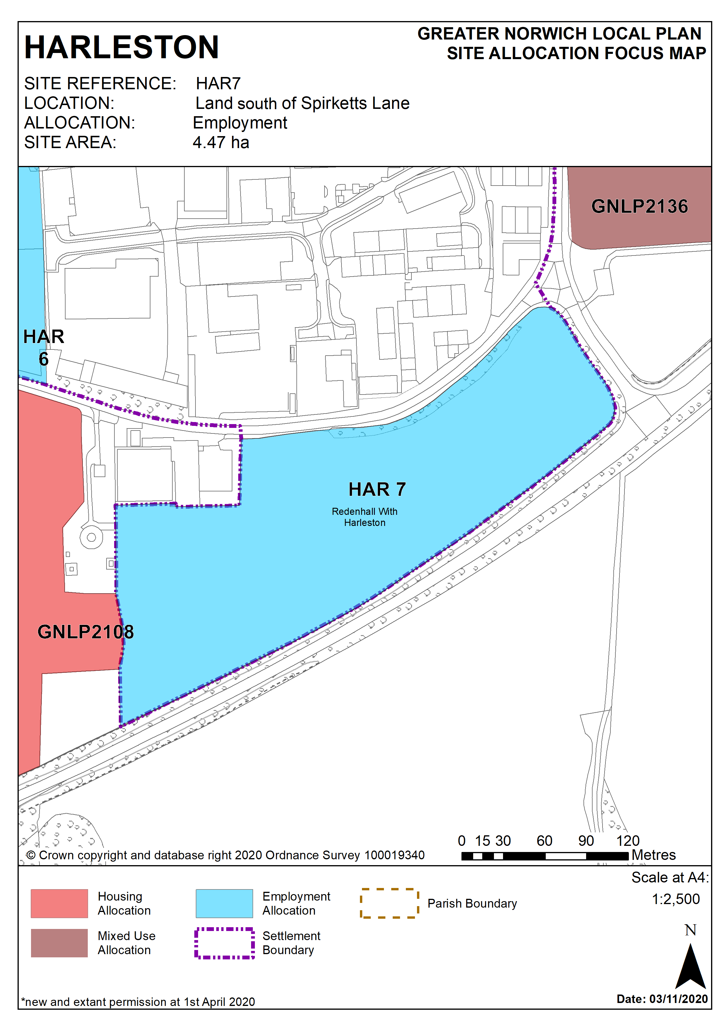
This site was allocated in 2015 as part of the South Norfolk Local Plan. It is located to the south of the town with vehicular access from Spirkett’s Lane. This is a recognised part of the town for commercial uses and it is expected that development can come forward within the new local plan time-period up to 2038.
Policy HAR 7
Land south of Spirketts Lane, Harleston (approx. 4.47 ha) is allocated for employment uses in class E(g) office, research and development, and industrial process, class B2 general industrial, and class B8 storage distribution.
The development will address all the following specific matters:
- Provide road access from Spirketts Lane (rather than directly off the A143).
- Provide footway/cycleway links for the length of the Spirketts Lane site frontage to join to new footway/cycleway links from allocated housing site HAR 4.
- Provide enhanced planting along all site boundaries.
- Protect the mature tree belt along the Spirkett's Lane frontage.
- Contribute towards green infrastructure protection or enhancement along the Waveney valley corridor.
- Deliver a suitable drainage strategy (SuDS where practicable).
- Wastewater infrastructure capacity must be confirmed prior to development taking place.
- Historic Environment Service to be consulted to determine any need for archaeological surveys prior to development.
Policy Map