4.38
This site was allocated in 2015 as part of the South Norfolk Local Plan. It is located to the south of the town with vehicular access from Fuller Road. The site’s location is recognised for commercial uses and the land is partially developed as premises for a retail wholesaler. It is expected that the remainder of the site will build out over the plan period up to 2038.
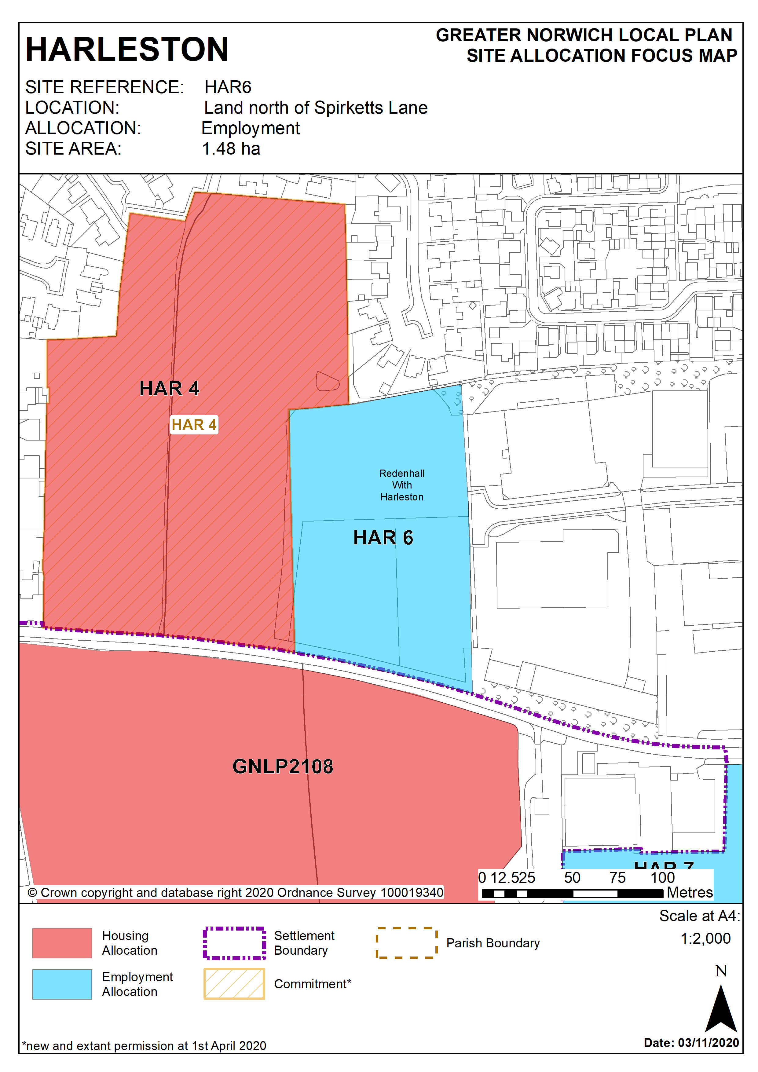
Policy HAR 6
Land north of Spirketts Lane, Harleston (approx. 1.48 ha) is allocated for employment uses in Class E(g)/B2.
The development will address all the following specific matters:
- Restrict employment uses to ensure that amenity impacts on adjacent housing are not unacceptable.
- Deliver pedestrian and cycleway links to Spirketts Lane and existing and proposed adjacent housing areas to the west.
- Provide enhanced landscape screening on western and northern boundaries of the site.
- Contribute towards green infrastructure protection or enhancement along the Waveney valley corridor.
- Deliver a suitable drainage strategy (SuDS where practicable).
- Wastewater infrastructure capacity must be confirmed prior to development taking place.
Policy Map