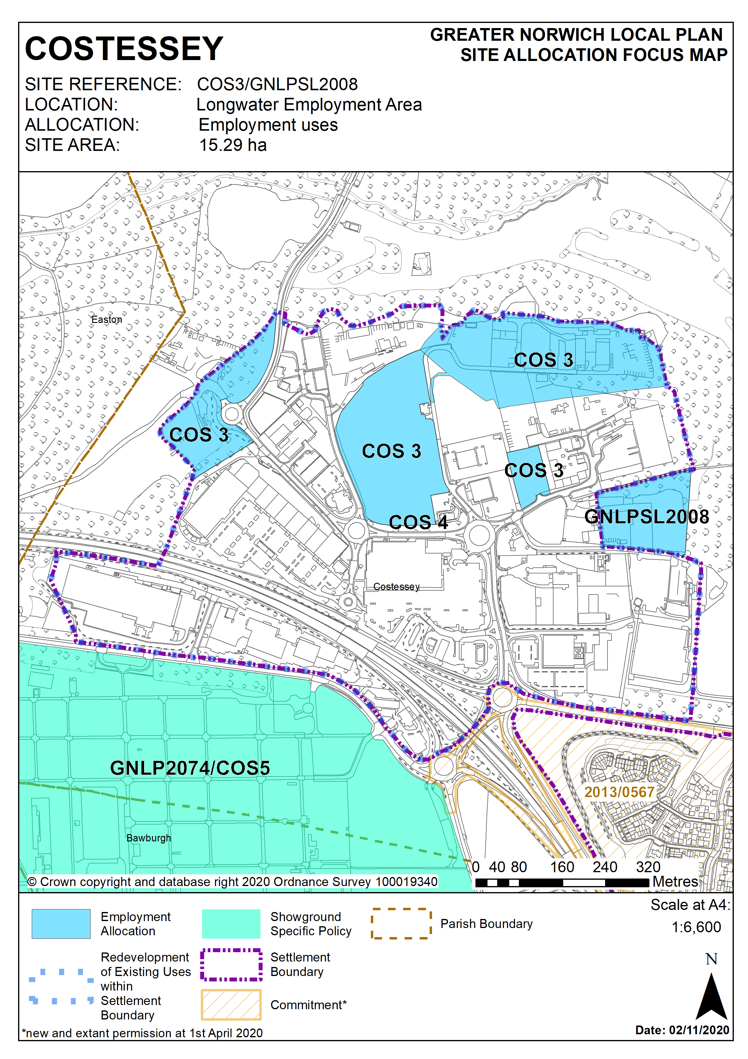
3.18
This site was allocated in the 2015 South Norfolk Local Plan and employment uses in this location remain appropriate. The site is re-allocated with additional land promoted as GNLPSL2008 which will be incorporated within the settlement boundary..
Policy COS 3/ GNLPSL2008
Strategic Allocation
Longwater Employment Area, Costessey (approx. 15.29 ha) is allocated for Employment uses.
The development will be expected to address the following specific matters:
Uses
- Principally for E(g) Use Class (2020) employment uses.
- Other employment uses that are not identified as main town centre uses in the National Planning Policy Framework, specifically further car showrooms and petrol filling stations.
Transport
- Appropriate and proportionate contributions to short, medium and long-term improvements to the A47 Longwater Junction to ensure that capacity does not become a constraint on development.
- Proportionate contributions to public transport improvements on the Dereham Road corridor and other public transport enhancements in accordance with the latest version of the Transport for Norwich implementation plan.
- Safe and convenient pedestrian and cycle links to key locations including access to Longwater retail and nearby residential locations at Queens Hill, New Costessey and Easton.
Constraints
- Wastewater infrastructure capacity must be confirmed prior to development taking place.
- Protection of Long Dale County Wildlife Site to the north of Employment Area.
- Norfolk Minerals and Waste Core Strategy Policy CS16 applies, as this site is underlain by safeguarded minerals resources and is within a minerals and waste consultation area. The benefits of extracting the minerals, if feasible, will be taken into consideration and developers will need to consult Norfolk County Council (Minerals and Waste) as part of any future applications on the site.
Policy Map