2.332
This part of the water treatment works is identified as surplus to Anglian Water’s operational needs and is planned to be decommissioned. The site, on a larger boundary, was allocated in the previous Local Plan but has not yet been developed. The principle of development on the site has already been accepted, and it is expected that development will take place within the new local plan time-period up to 2038. The site is re-allocated, on this reduced boundary, for residential-led mixed use development and public open space.
2.333
The majority of the site is within flood zone 2, whilst a small part of the site is in flood zone 3a. A site-specific flood risk assessment will need to be completed prior to the planning application stage. The area falling within flood zone 3a must not be developed for housing; instead, it should be included in the landscaping and open space provision. Since the site is over 1 hectare, a flood risk assessment is required, and appropriate mitigation measures should be provided as part of the development.
2.334
Development of the site will only be possible subsequent to decommissioning and will require consultation with the Health and Safety Executive. Development should take into account possible site contamination.
2.335
This site is a regionally important “industrial garden”, as identified by the Norfolk Historic Gardens Survey. An archaeological survey is required before any development takes place and the design of the development should seek to retain the special characteristics of the site. Three buildings on site, Eastgate House, Pump House 1 and Pump House 2, are locally listed; these should be retained for re-use or converted to residential uses.
2.336
The site is likely to accommodate approximately 60 homes. More homes may be accommodated, subject to an acceptable design and layout etc. being achieved.
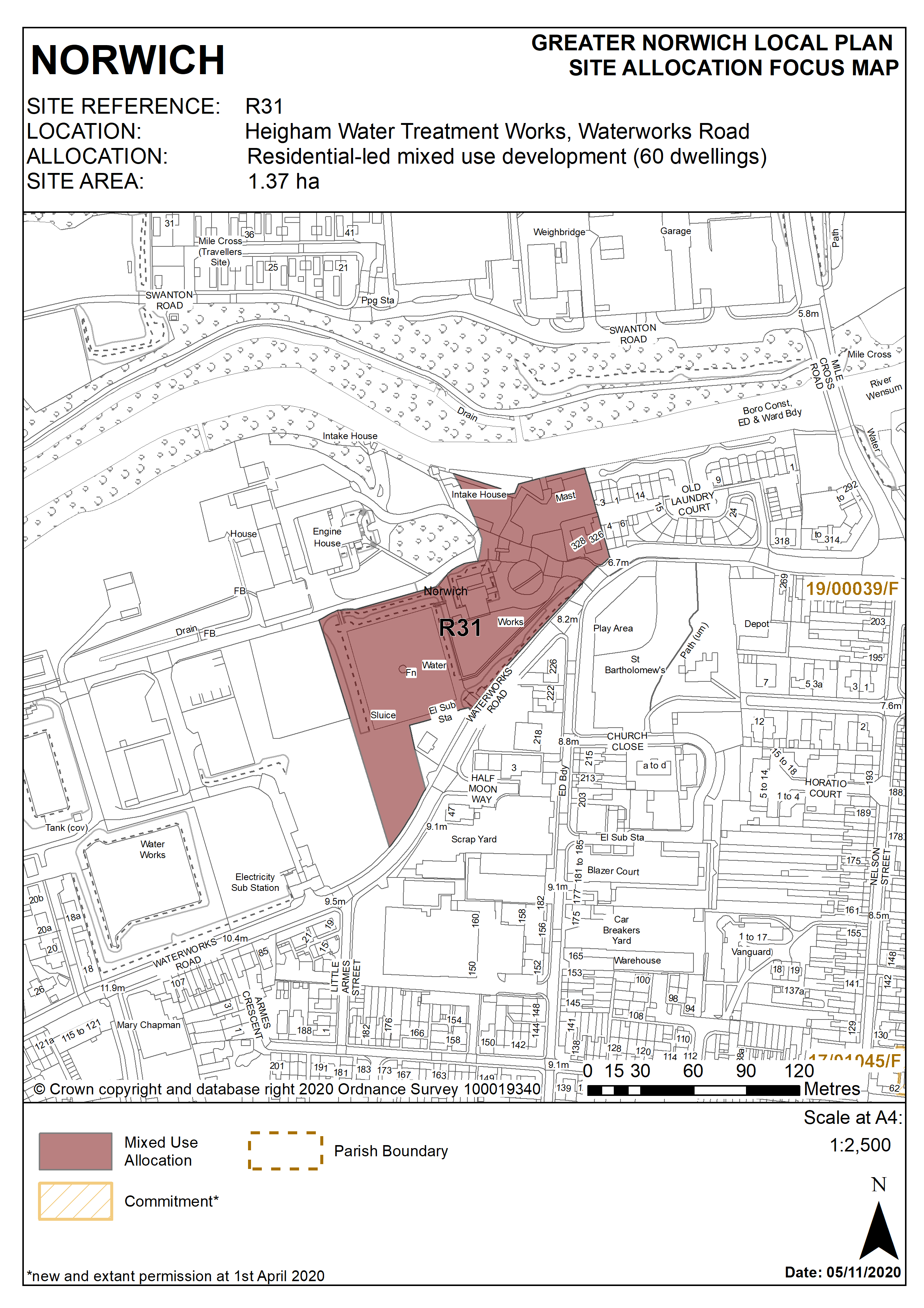
Policy R31
Heigham Water Treatment Works, Waterworks Road, Norwich (approx. 1.37ha) is allocated for housing led mixed use development and public open space. This will accommodate a minimum of 60 homes.
The development will achieve the following site-specific requirements:
- Achievement of a high quality, locally distinctive and flood-resilient design (including addressing identified risks from flooding from rivers and surface water flooding);
- The design must reflect the prominent riverside location and provide for the retention and enhancement of heritage assets within the site including the historic boundary wall on Waterworks Road; the locally listed Pump House 1 and Eastgate Lodge; as well as heritage assets adjacent to the site including the locally listed Pump House 2 buildings and grade II listed / scheduled monument St. Bartholomew’s Church, Heigham;
- A small element of business or commercial use is acceptable subject to uses being compatible with the continuation of water treatment operations on the adjoining site to the west and subject to any required variation or revocation of hazardous substance consents pertaining to those operations;
- Approximately 60 homes will be provided, depending on the appropriate mitigation measures undertaken, including the provision of adequate and appropriate access to the site;
- The land adjoining the River Wensum will provide a public open space with a publicly accessible riverside walk in accordance with policy 7.1 and the ‘River Wensum Strategy’ and subject to water security considerations;
- A high-quality landscaping scheme is required which provides for the protection of trees on site and the provision and enhancement of green infrastructure and biodiversity links;
- Contamination from existing uses on site should be assessed and mitigated;
- Norfolk Minerals and Waste Core Strategy Policy CS16 applies, as this site is partially underlain by safeguarded minerals resources. The benefits of extracting the minerals, if feasible, will be taken into consideration. Parts of the site are within the consultation area for a safeguarded Waste management site and Norfolk Minerals and Waste Core Strategy policy CS16 applies, while the waste site is active.
- An archaeological assessment will be required prior to development.
Policy Map