2.269
The site was allocated in the previous Local Plan but has not yet been developed. The gas holder previously on site has been decommissioned and removed. The principle of development on the site has already been accepted, and it is expected that development will take place within the new local plan time-period up to 2038. The site is re-allocated for residential development. As an existing allocation it has been considered in the calculation of the housing requirement.
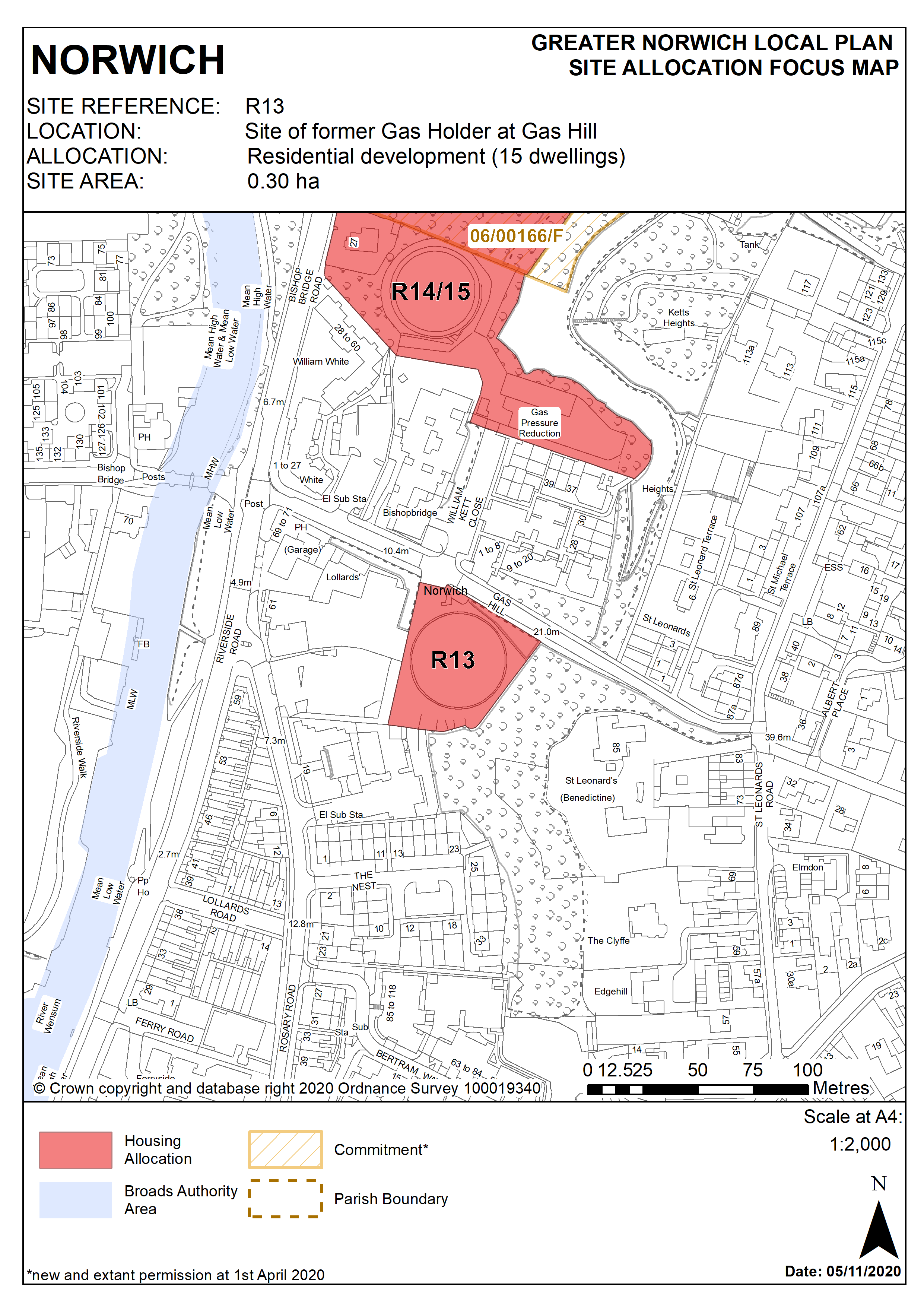
2.270
The site is located to the east of the city centre, on the steep slope of Gas Hill. It is 0.3 hectares in size. The site, consisting of the disused gas holder itself and small areas of incidental land, is flat. It is within an area with a mix of uses. It lies below the Thorpe wooded ridge, which includes the remains of the Benedictine St Leonards Priory to its east. It is topographically above a pub, furniture store and housing to the west and south. There is also housing to the north of the site.
2.271
The site is between the St Matthews Conservation Area and the Thorpe Hamlet Conservation Area. The steepness of the chalk escarpment east of the site has prevented any major development, resulting in a ‘green wedge’ of trees and greenery, creating an important refuge for wildlife and open space. The ridge provides excellent views to and from the city centre, though there is no public access to the Thorpe wooded ridge at this point.
2.272
This brownfield site is in an accessible location for housing, close to Bishop Bridge local centre, the city centre, bus routes and the railway station.
2.273
Design will have to take account of the site’s topography and development must not have a negative impact on geodiversity or on views to and from the Thorpe wooded ridge.
2.274
The development will have to address specific on site constraints relating to its former uses. Removal of the hazardous substance consent will be required. Ground conditions and contamination assessments will also be necessary.
2.275
As a minimum, protection and enhancement of geodiversity will include recording of geological features on site.
2.276
Access to the site will be via the existing access from Gas Hill.
2.777
Development needs to ensure that the water environment is protected. The site falls within Source Protection Zone 1, designated to protect water supplies, and therefore the water environment is particularly vulnerable in this location. Detailed discussions over this issue will be required with the Environment Agency to ensure that proposals are appropriate for the site and that the site is developed in a manner which protects the water environment.
2.278
The site is likely to accommodate at least 15 homes. More housing may be accommodated, subject to an acceptable design and layout being achieved
Policy R13
Site of former Gas Holder at Gas Hill, Norwich (approx. 0.30ha) is allocated for residential development. This will accommodate a minimum of 15 homes.
The development will achieve the following site-specific requirements:
- Achievement of a high quality, locally distinctive design of a scale and form which reflects and responds to its prominent location on the hillside east of the city centre adjacent to Thorpe wooded ridge. Development should blend in with the existing pattern of development in this location
- Development should respect the heritage significance and setting of the adjacent Thorpe Hamlet Conservation Area and of the scheduled remains of St Leonards Priory. The site is in close proximity to Cow Tower scheduled monument, design of development on this site should preserve and enhance the setting of adjacent heritage assets.
- Protection and enhancement of key green infrastructure, biodiversity and geodiversity assets within the site;
- Ensures a high level of flood resilience and incorporates appropriate mitigation measures addressing identified risks from surface water flooding);
- Development will not take place prior to the revocation of the hazardous substance consent.
- Site contamination arising from the former gas storage use should be addressed and mitigated.
- Car free or low car development in accordance with policy 2 is appropriate in this location.
Policy Map