6.73
This site to the west of West Lane is proposed for residential allocation recognising that a sensitive design will be required due to its proximity to heritage assets including the Grade I listed church of St Mary and St Andrew and St Faith Priory which is a scheduled monument.
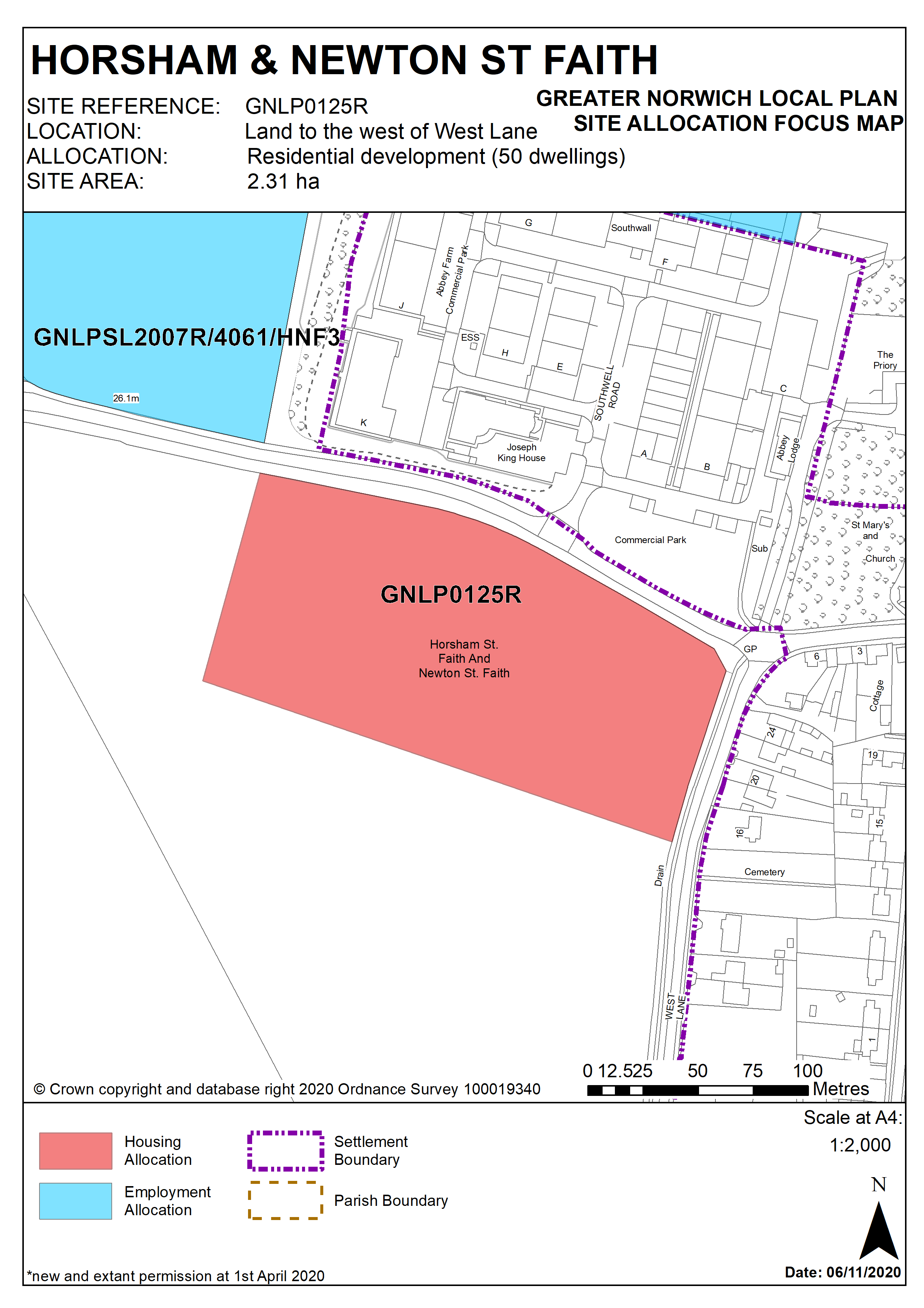
Policy GNLP0125R
Land to the west of West Lane, Horsham St Faith (approx. 2.31ha) is allocated for residential development. The site is likely to accommodate approximately 50 homes.
More homes may be accommodated, subject to an acceptable design and layout, as well as infrastructure constraints.
The development will be expected to address the following specific matters:
- Provision of frontage footways and carriageway widening.
- Implementation of any improvements required to the walking route to school, particularly at junctions en-route.
- Provision of two vehicular accesses
- Any development must conserve and enhance the significance of the grade I listed Church of St Mary and St Andrew, the scheduled monument St Faith Priory and the conservation area, including any contribution made to that significance by setting. This includes but is not limited to a sensitive design and layout. Due to the sensitivities of this site a Heritage Impact Assessment will be required.
Policy Map