6.38
This site west of Foundry Close is allocated for residential development. The site is located next to the Broadland Local Plan FOU1 allocation, which is now built out, and has a safe pedestrian route to the local primary school.
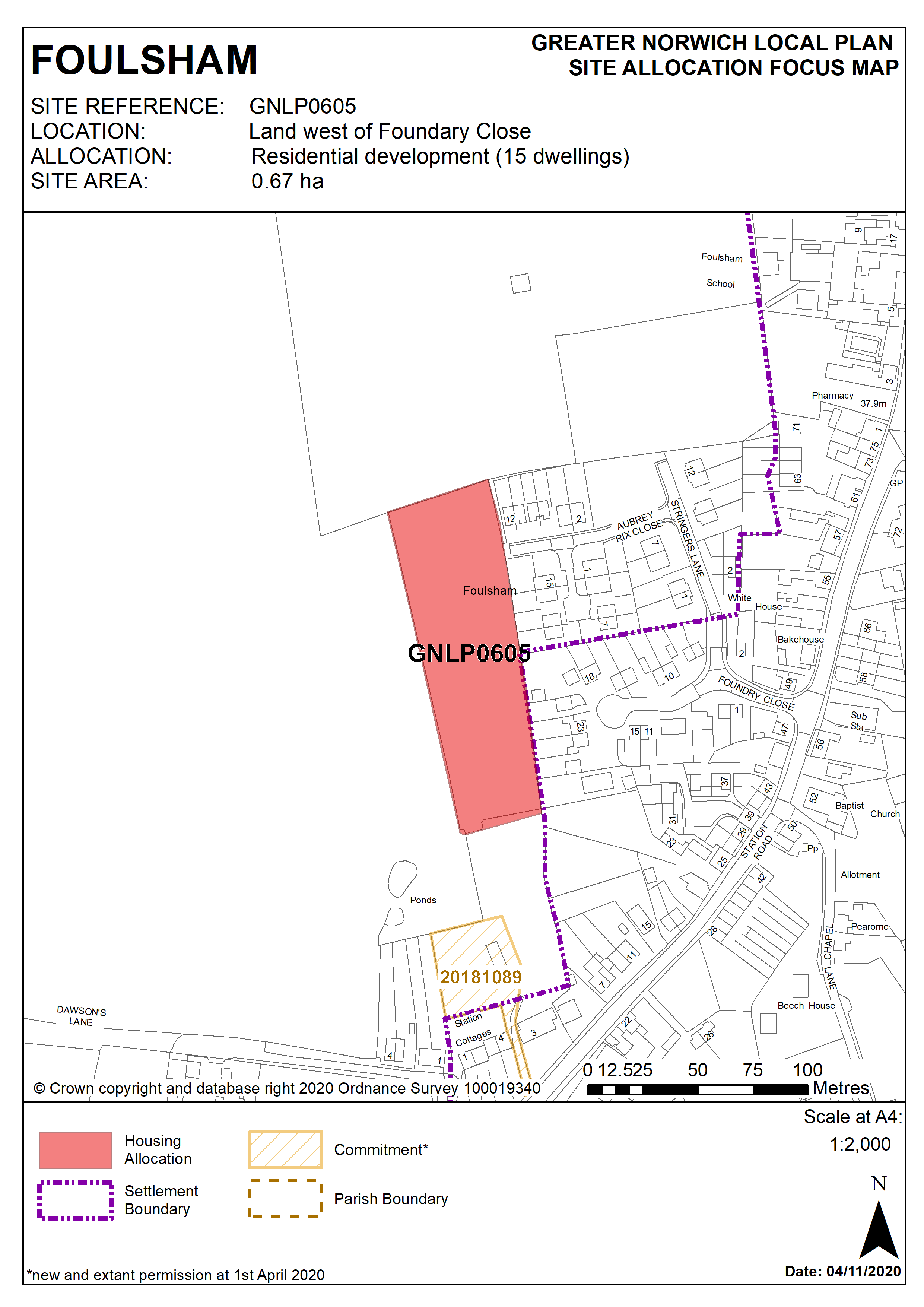
Policy GNLP0605
Land west of Foundry Close, Foulsham (0.67ha) is allocated for residential development. The site is likely to accommodate approximately 15 homes.
More homes may be accommodated, subject to an acceptable design and layout, as well as infrastructure constraints.
The development will be expected to address the following specific matters:
- Access (vehicular and pedestrian) to be via Stringer’s Lane and Aubrey Rix Close.
- Any development must conserve and enhance the significance of grade II listed buildings to the south of the site, particularly Station Farmhouse and Bracken Brae, 5 Station Road and the Foulsham conservation area to the south and east, including any contribution made to that significance by setting.
Policy Map