3.67
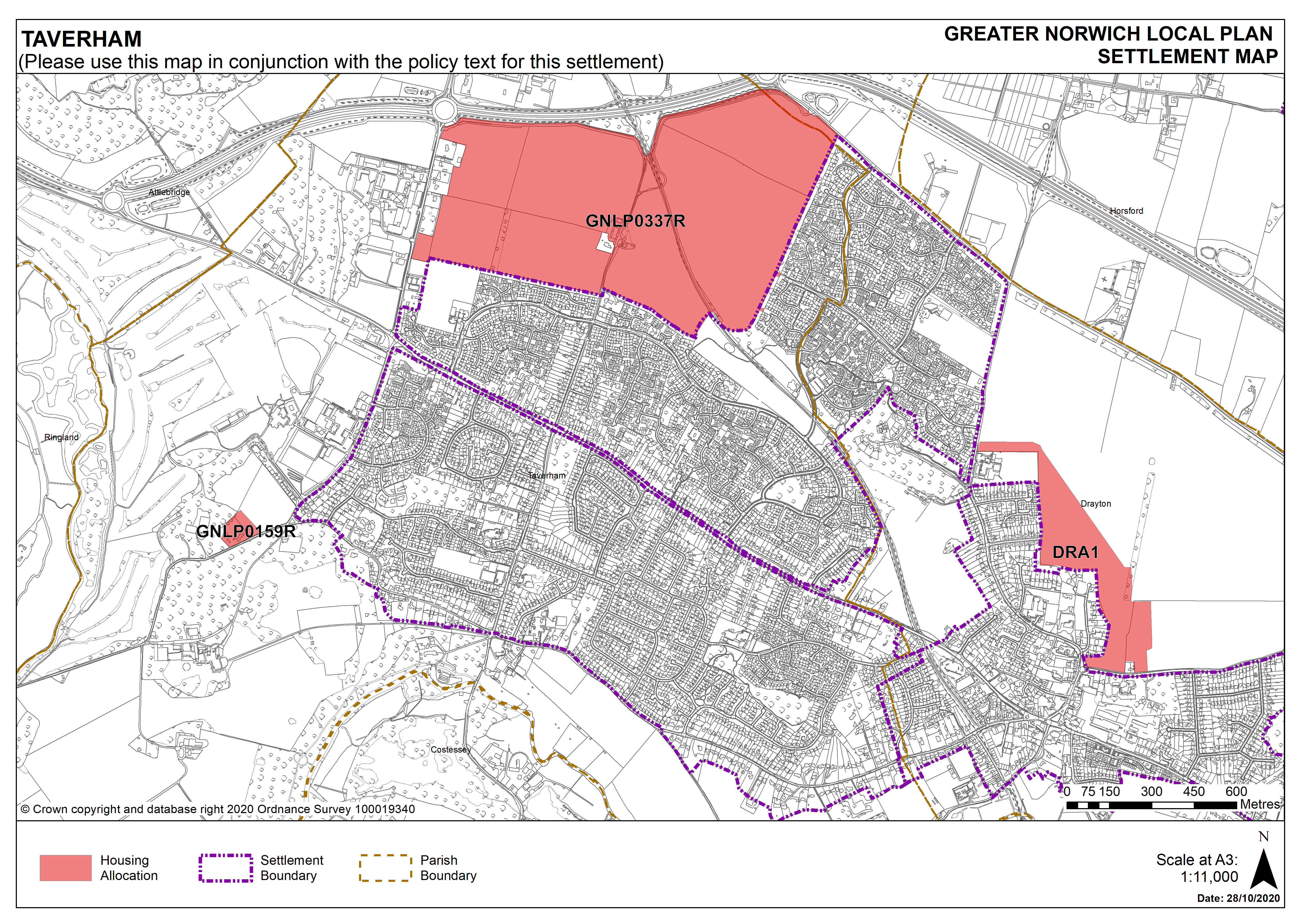
Taverham is identified as a fringe parish in policy 7.1. There is a good range of services in the parish including a library and recreation facilities on Sandy Lane; some retail and a pub along the Fakenham Road and Taverham High School on Beech Avenue. Planning permission exists for a new supermarket and other retail on Fir Covert Road to complement the existing garden centre. The A1067 Fakenham Road offers good public transport connections to Norwich, and to the north the A1270 Broadland Northway has improved transport connectivity more generally. In terms of the built form and landscape setting of Taverham there are significant blocks of woodland across the parish. The Marriott’s Way, the former railway (and now long-distance footpath), takes a north-west to south-east direction, through the parish, defining the landscape, and dividing Taverham from Drayton on its eastern boundary. Of ecological importance, the River Wensum has the status of a Special Area of Conservation (SAC), and also marks Taverham’s western and southern boundaries. A neighbourhood plan for Taverham is ready for referendum (at the time of writing).
3.68
The parish of Ringland is on the western side of the River Wensum valley and in contrast to Taverham the parish is rural. The settlement of Ringwood is small, consisting of mainly ribbon development along The Street. Facilities are limited, but include parish rooms and a pub. As well as farmland there are several large blocks of woodland, a number of County Wildlife Sites, and an area of Ancient Woodland (Jennis Wood).
3.69
There are two site allocations proposed in Taverham providing for 1,417 new homes as well as additional facilities such as, a new school and a local centre offering a medical clinic as well as, protection to the Marriott’s Way. There are no carried forward allocations but a total of 121 additional dwellings with planning permission on small sites. This gives a total deliverable housing commitment for the cluster of 1,538 homes between 2018 – 2038.
3.70
There are no sites allocations Ringland, no carried forward allocations and one dwelling with planning permission.
3.71
All site allocations are expected to address standard requirements associated with development. These vary from place to place but are likely to include mitigations for flood risk (as well as SUDs), highways improvements, safeguarding of minerals resources, land remediation, measures to protect the environment, biodiversity, and landscape intrusion.
Settlement Map