2.28
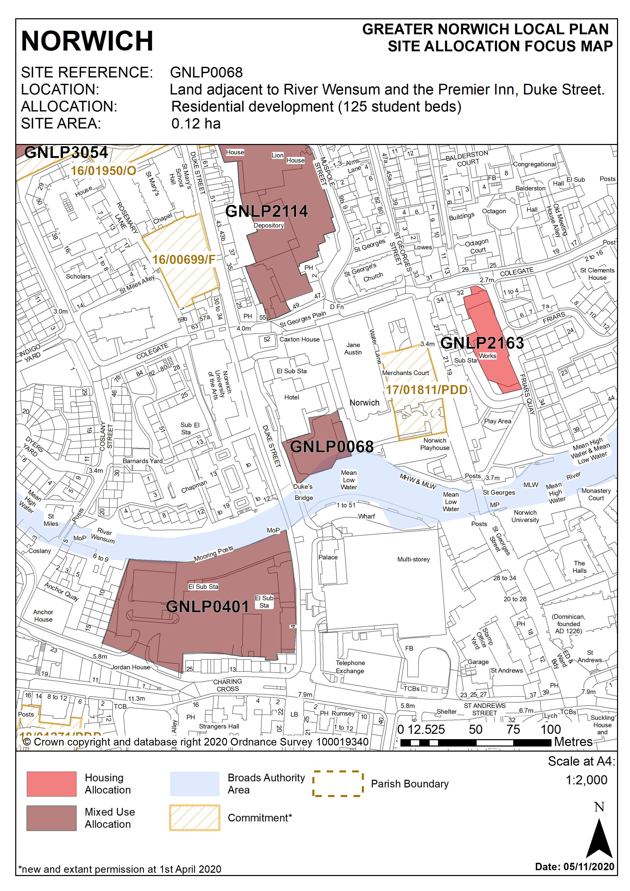
This 0.12ha site is currently occupied by a surface car park accessed from Duke Street. It is bordered by Duke Street to the West, by a hotel to the north, by a school to the east and by the River Wensum to the South. Development offers opportunity for landscape improvements and provision of a new section of riverside walk on the north bank of the river Wensum.
2.30
Early engagement with statutory consultees is always recommended, in this case most particularly the Environment Agency, the Broads Authority and Anglian Water to address flood and water disposal issues.
2.31
Although not previously allocated in the Local Plan, the site benefits from an extant 2004 permission for 21 homes. That permission has been implemented and remains valid through the construction of the hotel forming part of the same approved proposals. Further to this, consent was granted in November 2019 for the construction of a 139 bed Purpose Built Student Accommodation Block (18/01552/F). The site is likely to accommodate at least 25 homes or 125 student bedrooms. More may be accommodated, subject to an acceptable design and layout etc. being achieved.
POLICY GNLP0068
Land adjacent to the River Wensum and the Premier Inn, Duke Street (approx. 0.12ha) is allocated for residential-led mixed use development. This will include a minimum of 25 homes (or if developed for student accommodation, a minimum of 125 student bedrooms) A small element of commercial, office, and/or educational use at ground floor level may also be acceptable.
The development will achieve the following site-specific requirements:
- Achievement of a high quality, locally distinctive design.
- A scale and form which respects and takes advantage of its riverside context;
- Conserve and enhance the significance of the City Centre Conservation Area and nearby listed buildings (including any contribution made to their significance by setting),
- Ensures a high level of flood resilience and incorporates appropriate mitigation measures; (including addressing identified risks from flooding from rivers and surface water flooding);
- If developed as purpose-built student accommodation, Affordable Housing contributions to be provided as a commuted sum in accordance with Norwich City Council Affordable Housing supplementary planning document (2019) or any successor
- Reduced levels of residential car parking to achieve low car or car-free housing
- Provision of public access to and along the river for walking and cycling, including a ramp from Duke Street, designed to facilitate a future extension of the riverside walk eastward to St Georges Street in accordance with policy 7.1 and the ‘River Wensum Strategy’;
- High quality landscaping, planting and biodiversity enhancements particularly along the river edge;
- Protection of bankside access for maintenance purposes.
- Existing surface water discharge point located within the boundary of the site which must be addressed as part of any scheme put forward.
Policy Map