6.94
This site to the east of Station Road is allocated for residential development as it has minimal constraints. However, it is accepted that it is not possible to provide an off-carriageway pedestrian footway for the whole route to Reedham Primary School. The site is allocated subject to vehicular access via adjacent existing Broadland Local Plan site allocation RED1 and footpath connection with Public Rights of Way at the north and east boundaries of the site to facilitate a traffic free route to school.
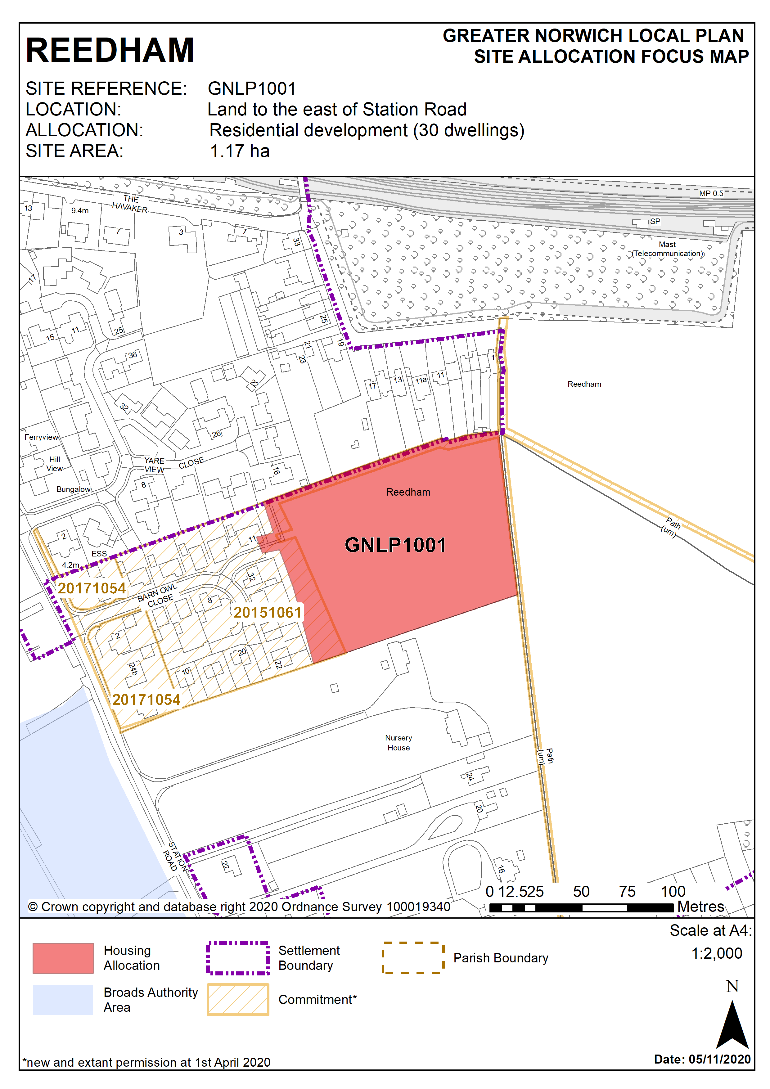
Policy GNLP1001
Land to east of Station Road, Reedham (approx. 1.17Ha) is allocated for residential development. The site is likely to accommodate approximately 30 homes.
More homes may be accommodated, subject to an acceptable design and layout as well as infrastructure constraints.
The development will be expected to address the following specific matters:
- Pedestrian and vehicular access to be via Barn Owl Close.
- Respect, protect and if appropriate enhance the area of Tree Preservation Order protected trees on the northern side of development.
- Appropriate enhancement and links to the PROW that is to the east of the site noting that this could provide a traffic free route for part of the journey to the school.
- Potential impact of the scheme on the Broads Authority Executive Area to be considered and addressed as appropriate through sensitive design such as low ridge heights, reduced scale/massing and screen planting
- The trees/hedgerows surrounding the site will be protected, enhanced and incorporated into the scheme.
Policy Map