6.31
This site at Rectory Road, south of the Bure Valley Railway is allocated for residential development. Vehicular access will need to be taken through the adjacent COL1 allocation and a Transport Assessment will be needed. The site should be masterplanned with COL1 to bring forward a cohesive development. The site is adjacent to the Bure Valley Railway and the Bure Valley path, which are important tourism and GI assets that should be protected.
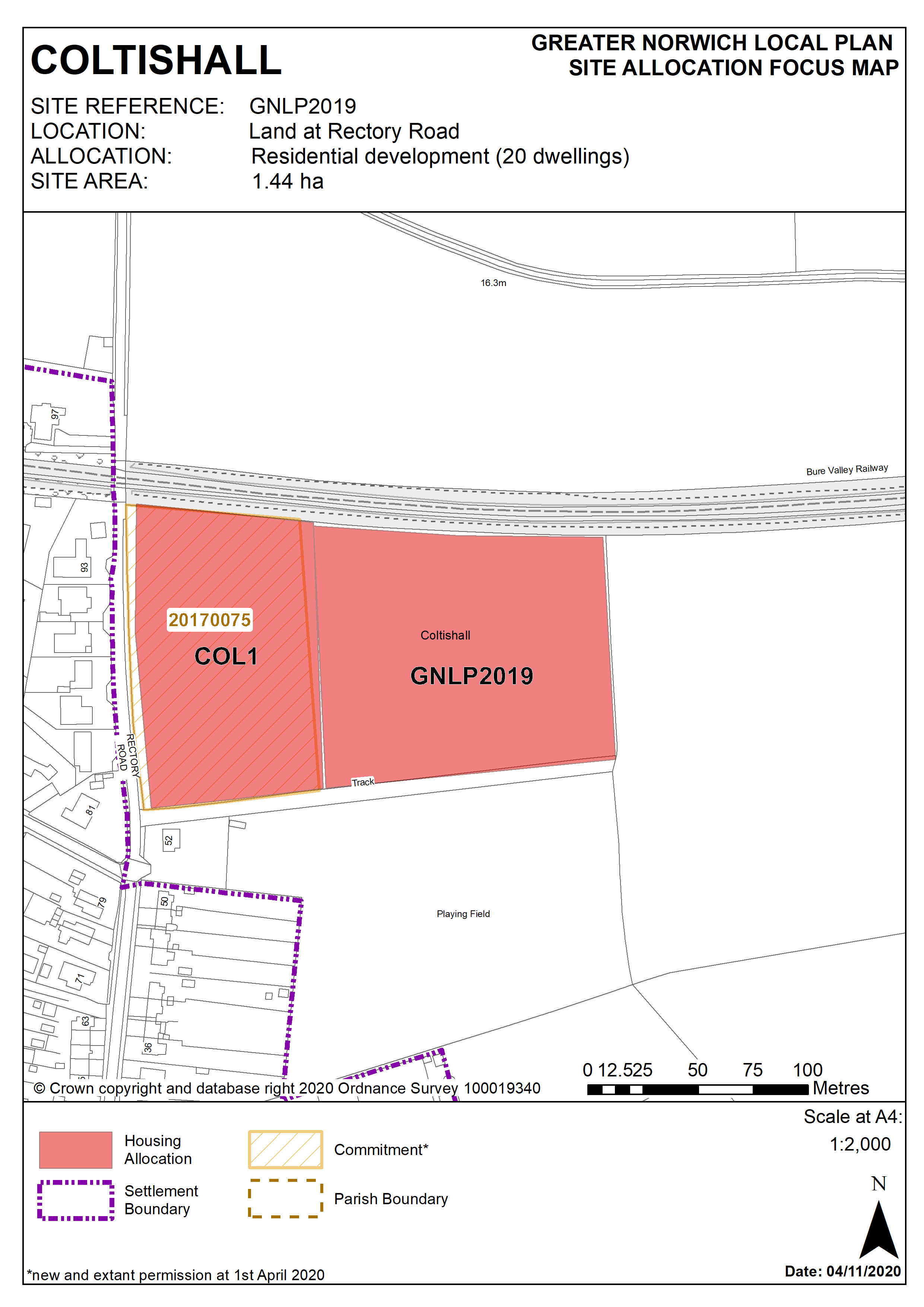
Policy GNLP2019
Land at Rectory Road and south of the Bure Valley Railway, Coltishall (approx. 1.44 ha) is allocated for residential development. The site is likely to accommodate approximately 20 homes.
More homes may be accommodated, subject to an acceptable design and layout, as well as infrastructure constraints.
The development will be expected to address the following specific matters:
- Site should be masterplanned with existing COL1 allocation to bring forward a cohesive development.
- Vehicular access will be from Rectory Road via the existing COL1 allocation, with off-site highway improvements to connect to the existing footpath on Rectory Road near the junction with Westbourne Road.
- Due to highway constraints in the vicinity of Rectory Road, submission of a transport assessment to assess the traffic implications of the proposed development on the surrounding road network demonstrating that the proposed scale of development can be accommodated will be required.
- Adequate landscaping and green infrastructure will be needed to protect the rural setting of the village, especially to the eastern boundary and to mitigate the potential for noise pollution and vibrations resulting from proximity of the Bure Valley Railway to the north.
Policy Map