6.22
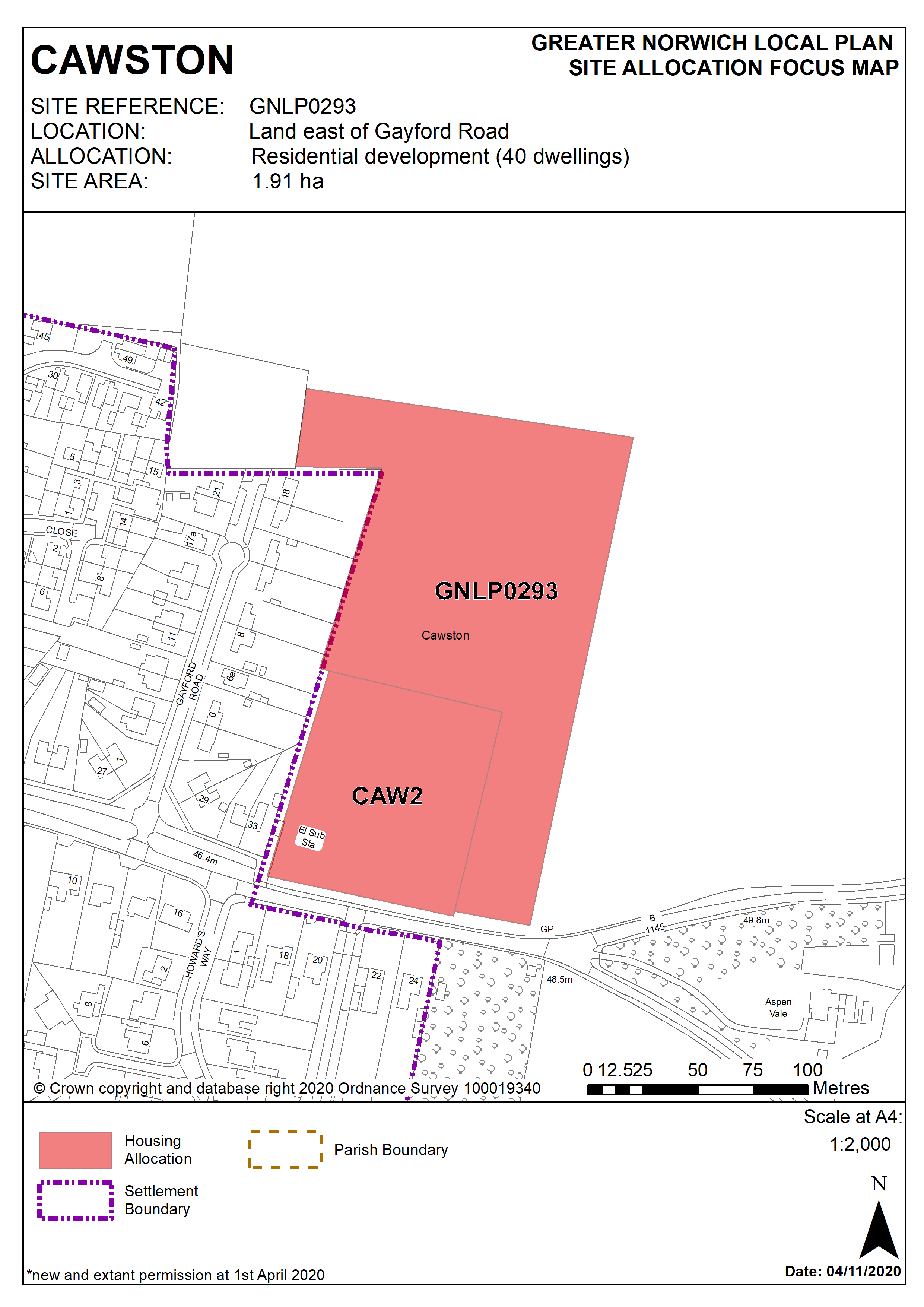
This site, east of Gayford Road is allocated for residential use as it is adjacent to the existing settlement limit, close to Cawston Primary School with minimal other constraints. The site should be masterplanned with the adjacent CAW2 allocation to bring forward a cohesive development.
Policy GNLP0293
Land east of Gayford Road, Cawston (approx. 1.91 ha, excluding existing CAW2 allocation) is allocated for residential development. The site is likely to accommodate approximately 40 homes
More homes may be accommodated, subject to acceptable design and layout as well as infrastructure constraints.
The development will be expected to address the following specific matters:
- Site should be masterplanned with existing CAW2 allocation to bring forward a cohesive development
- Access (vehicular and pedestrian) will be from Aylsham Road.
- Carriageway improvements to the vehicular access on Aylsham Road and a new 2 metre footway connection along the site frontage that connects to the existing footpath will be needed.
- A pedestrian crossing facility on Aylsham Road to the primary school.
- Adequate landscaping and green infrastructure to protect the rural setting of the village, especially to the eastern and northern boundaries.
- Norfolk Minerals and Waste Core Strategy Policy CS16 applies, as this site is underlain by safeguarded minerals resources. The benefits of extracting the minerals, if feasible, will be taken into consideration.
Policy Map