6.13
This site to the east of Aylsham Road is allocated for residential development as it is within an accessible walking/cycling distance of facilities such as Buxton Primary School although a short section of footway will need to be provided at the north east side of Aylsham Road to ensure a continuous safe route to school. Visibility to the north east could be challenging and it is likely that the speed limit will need to be extended.
6.14
There is currently not enough capacity in Aylsham Water Recycling Centre permit to accommodate development and no plans to upgrade in terms of flow in PR19, only plans to increase storage at intermittent CSOs. Development will therefore require phasing in line with upgrades to the Water Recycling Centre and evidence of liaison with Anglian Water on this matter will need to be provided.
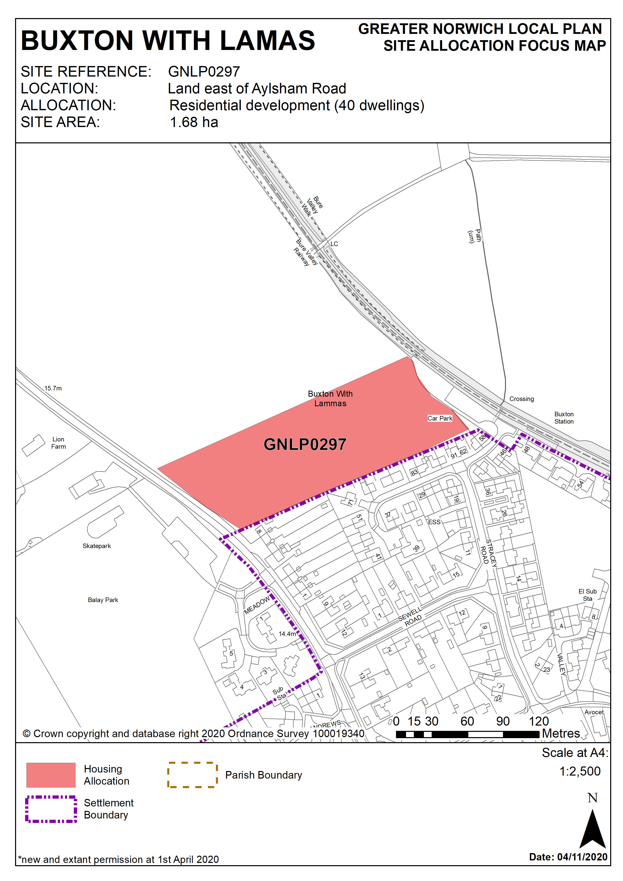
Policy GNLP0297
Land east of Aylsham Road, Buxton with Lamas (1.68ha) is allocated for residential development. The site is likely to accommodate approximately 40 homes.
More homes may be accommodated, subject to an acceptable design and layout, as well as infrastructure constraints.
The development will be expected to address the following specific matters:
- Access (vehicular and pedestrian) will be from Aylsham Road.
- Lower speed limit will need to be extended.
- Footway will be required at north east side of Aylsham Road to connect with existing facility and provide continuous pedestrian route to the school.
- Some hedgerow and tree removal likely for visibility and access but aim to minimise loss of contribution to the landscape.
- Landscaping to mitigate the potential for noise pollution and vibrations resulting from proximity of the site to the Bure Valley Railway and to mitigate for the potential loss of views experienced by users of the nearby Public Right of Way.
- Development will need phasing in line with upgrades to the Aylsham Water Recycling Centre.
Policy Map