4.36
This site was allocated in 2015 as part of the South Norfolk Local Plan. It is located to the south of the town with vehicular access from Spirkett’s Lane. This is a recognised part of the town for commercial uses and it is expected that development can come forward within the new local plan time-period up to 2038.
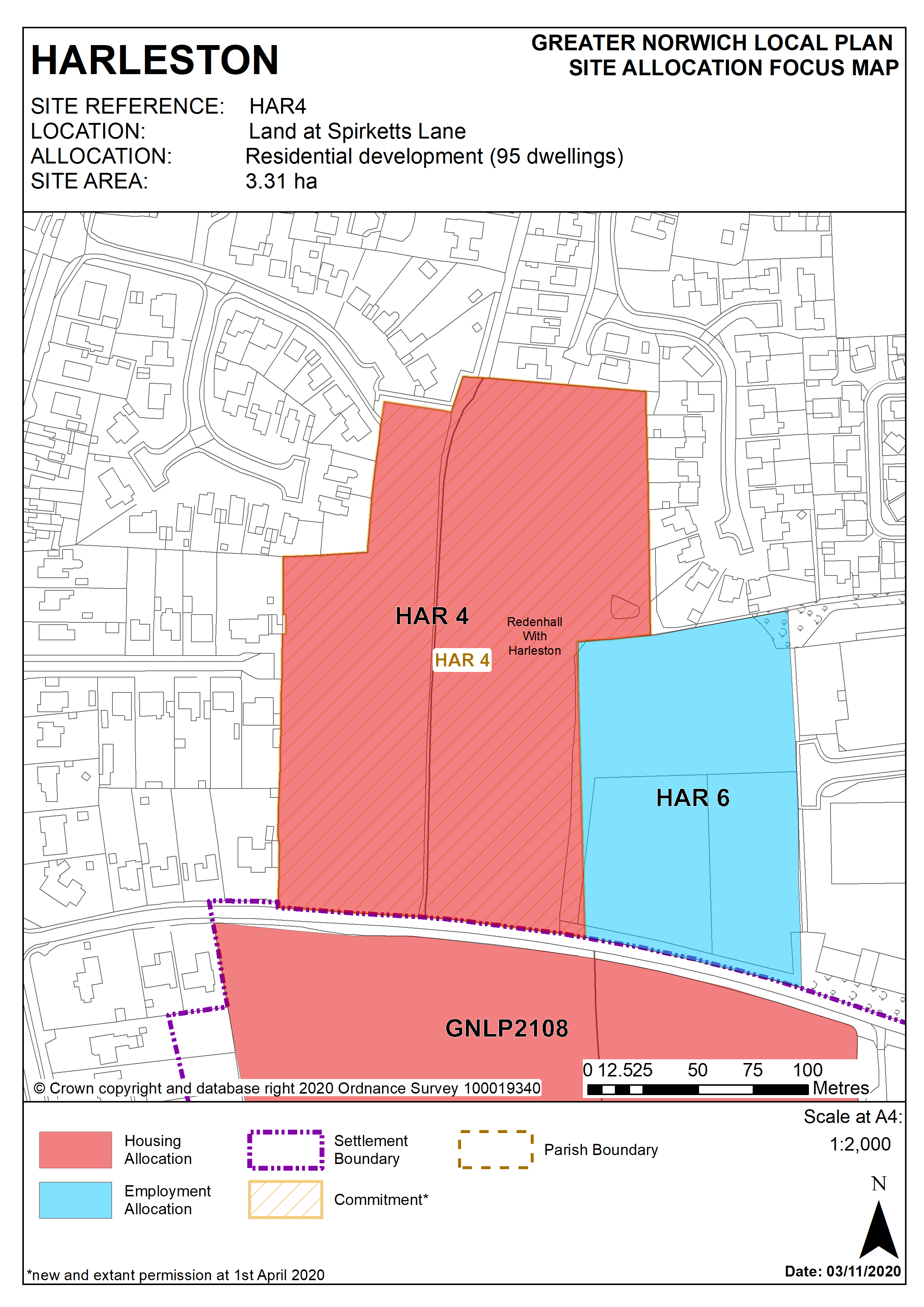
Policy HAR 4
Land at Spirketts Lane, Harleston (approx. 3.31 ha) is allocated for residential development. This will accommodate approximately 95 homes.
More homes may be accommodated, subject to an acceptable design and layout, as well as infrastructure constraints.
The development will address all the following specific matters:
- Provide new and/or improved pedestrian and cycleway links to the town centre, Fuller Road Industrial Estate and other allocated employment sites;
- Provide highways access via Spirketts Lane;
- Provide appropriate screening along the south-eastern part of the site bordering the existing lorry park to mitigate potential impacts on residential areas;
- Contribute towards green infrastructure protection or enhancement along the Waveney valley corridor;
- Implement a suitable drainage strategy where practicable; and,
- Wastewater infrastructure capacity must be confirmed prior to development taking place.
Policy Map