4.23
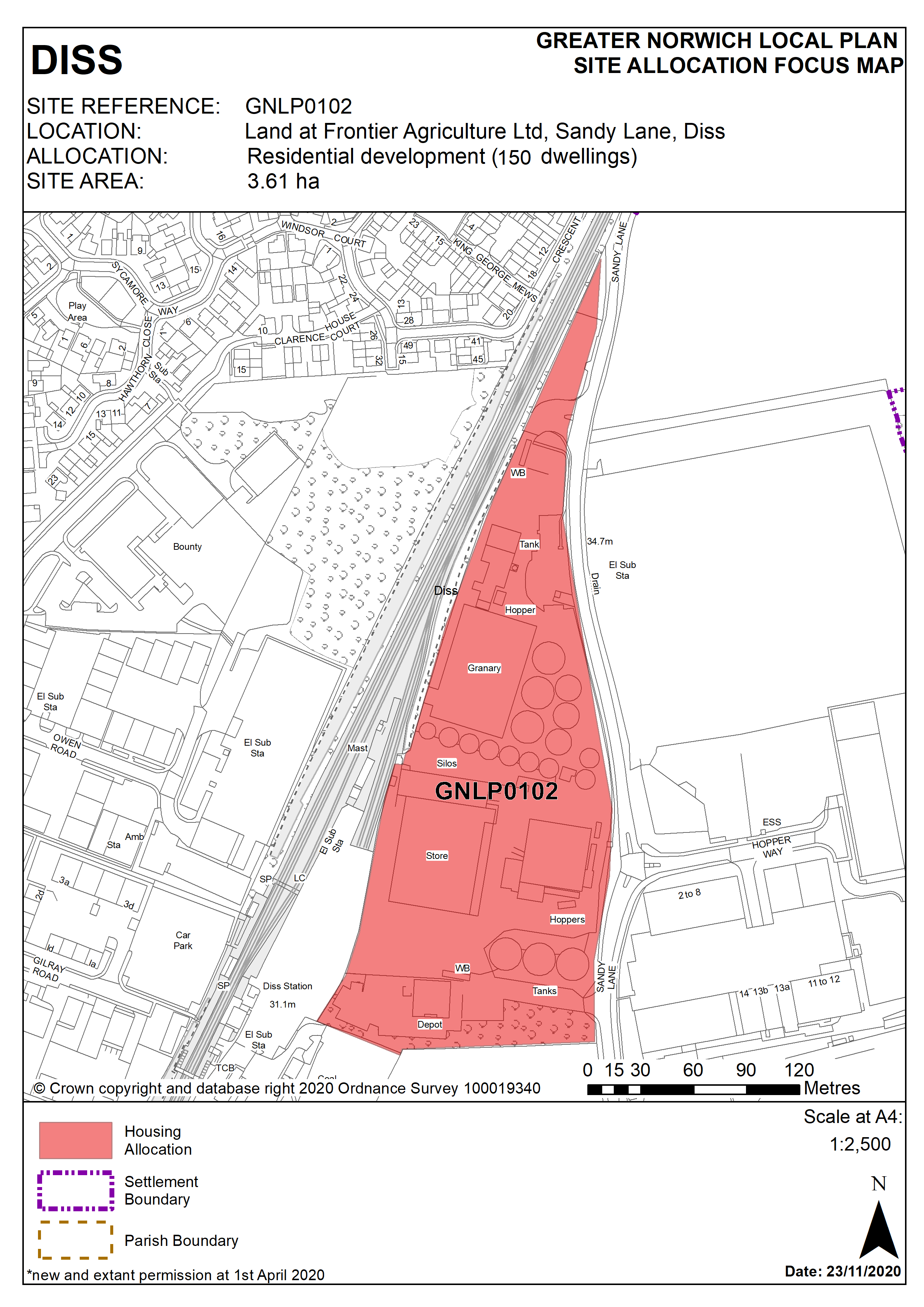
This site is located to the east of the railway in an area historically characterised by employment premises. Nevertheless, this is an area in transition. In recent years residential development has come forward to the south in the vicinity of Nelson Road. To reflect the land’s brownfield status and surroundings policy requirements reference considerations of land contamination, noise from the railway, and surface water flood risk. Various highway, pedestrian and cycle requirements are also required of a future development scheme. The number of homes sought is set at 150 due to the highly sustainable town centre location but the exact figure will be subject to detailed design and viability considerations.
Policy GNLP0102
Land at Frontier Agriculture Ltd, Sandy Lane, Diss (approx. 3.61 ha) is allocated for residential development. The site is likely to accommodate approximately 150 homes
The development will be expected to address the following specific matters:
- Assessment of site contamination with subsequent mitigation and considerations of development viability if required.
- Assessment and mitigation measures to address adverse impacts from the railway and neighbouring employment uses on residential amenity.
- Consider and mitigate surface water flood risk.
- Road widening of Sandy Lane to a minimum of 6.0 metres for the extent of frontage.
- Provision of a 3.0m wide cycle/footway at the site frontage to link to Nelson Road.
- The trees/hedgerows surrounding the site will be protected, enhanced and incorporated into the scheme.
- Historic Environment Record to be consulted to determine any need for archaeological surveys prior to development.
Policy Map