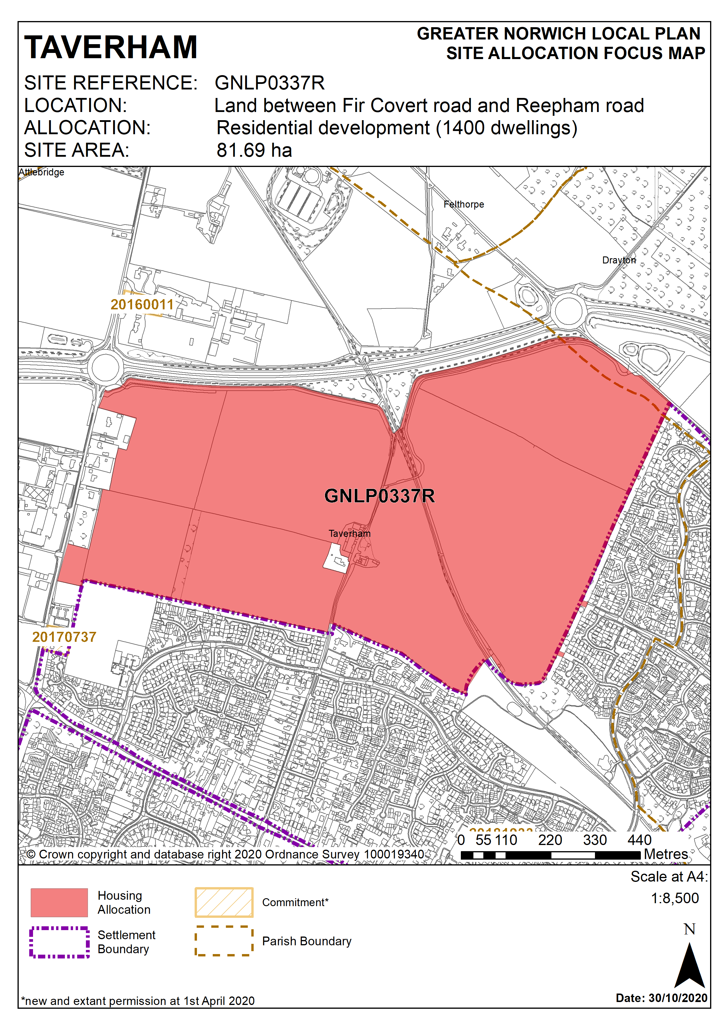
3.72
This is a strategic-scale site well-related to the existing edge of Thorpe Marriott with no major constraints to make the site unsuitable for development. The site will need to be masterplanned to provide a local centre, community and recreation facilities including a school and medical care facility. Highway improvements will be needed including provision of roundabout access at Fir Covert Road, priority access at Reepham Road and traffic signals at the A1067 Fakenham Road/Fir Covert Road.
Policy GNLP0337R
Strategic Allocation
Land between Fir Covert Road and Reepham Road, Taverham (81.69ha) is allocated for residential development. The site will accommodate at least 1,400 homes including specialist care housing and older persons housing units, associated public open space, local centre, primary school and local medical centre.
More homes may be accommodated, subject to an acceptable design and layout, as well as infrastructure constraints.
The development will be expected to address the following specific matters:
- Preparation of a masterplan to guide the development, submitted as part of the application for planning permission.
- Provision of on-site recreation to encourage healthy lifestyles, in accordance with relevant policies.
- 2ha safeguarded for provision of primary school.
- Land safeguarded for provision of medical care facility.
- A local centre at the heart of the development, easily accessible to surrounding residential areas
The masterplan should demonstrate:
- Detailed arrangements for access (vehicular and pedestrian) such as from Reepham Road and Fir Covert Road, pedestrian/cycle links at Felsham Way, Ganners Hill, Breck Farm Lane, and Kingswood Avenue.
- The distribution of land-uses across the site. The school and medical care facility should be centrally located on the site.
- Off-site improvements to the highway network which may include provision of a new roundabout on Reepham Road, and Fir Covert Road including proposed link road.
- No adverse effect on the operation of the water treatment works.
- Safeguarding landscape enhancements and buffer of the Marriott’s Way.
- The approach to phasing of development across the site.
- Provision of a significant landscape buffer adjacent to A1270 and adequate noise mitigation measures to protect residential amenity.
- Inclusion of pollution control techniques to ensure that development does not lead to pollution of the water environment as the site falls within source protection zone 3.
- Submission of an Arboricultural Impact Assessment (AIA) to protect or to mitigate any harm to trees on site.
- Submission of ecological assessment to identify key ecological networks and habitats to be preserved and enhanced through the development.
- Mitigation of surface water flooding onsite.
- Approach to infrastructure delivery on and off site.
- Norfolk Minerals and Waste Core Strategy Policy CS16 applies, as this site is underlain by safeguarded minerals resources. The benefits of extracting the minerals, if feasible, will be taken into consideration
Policy Map