3.65
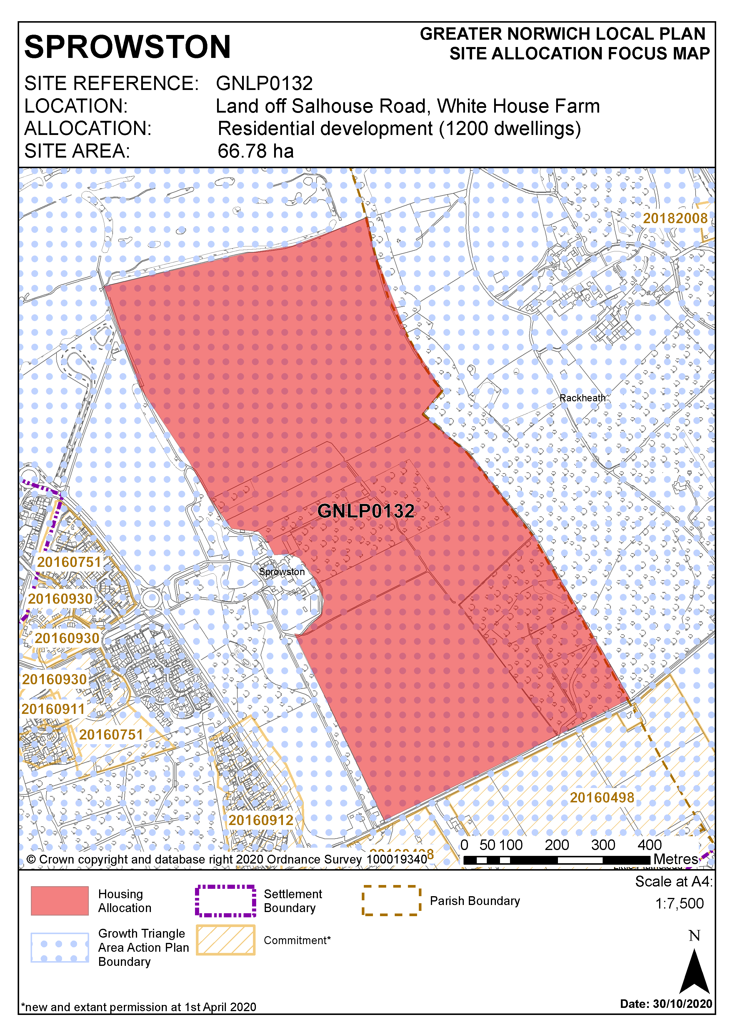
This is a large strategic scale greenfield site off Salhouse Road adjacent to a major existing allocation within the North East Growth Triangle AAP. There are no major constraints to make the site unsuitable for development, therefore the site is allocated subject to an acceptable masterplan incorporating the requirements set out in the policy below.
Policy GNLP0132
Strategic Allocation
Land off Blue Boar Lane/Salhouse Road, White House Farm, Sprowston. An area of approximately 66.78 ha is allocated for residential development. The site is expected to accommodate approximately 1,200 homes , open space and a new high school
The arrangement and interrelationship of different land uses resulting from the development of the site will be established through a participative masterplanning process. The development of the site will be in accordance with the resulting masterplan, which shall be submitted as part of the planning application for the site.
The masterplan should clearly demonstrate how the development has been designed to respond to the particular characteristics of the site and to interact and function appropriately with adjacent development sites. The masterplan should demonstrate how homes, jobs, services and facilities have been integrated with walking and cycling, public transport facilities/services, provision for private vehicles and green infrastructure.
Development will not be commenced until a phasing plan indicating the orderly sequence of development has been approved. The phasing plan will need to show how infrastructure (including green infrastructure) and services are to be co-ordinated with the development of the site.
The masterplan should include:
- Vehicular, pedestrian and cycle access to the site via Salhouse Road and Atlantic Avenue.
- A new link road from Salhouse Road to Atlantic Avenue which includes footway and cycleway provision.
- The provision of a footway and cycleway along the southern boundary of the site adjacent to Salhouse Road, continuing provision delivered through the development of adjacent land.
- Off-site improvements to the highway network as necessary to address the impact of development.
- Up to 12 ha of the site should be safeguarded to incorporate a well-located High School. An off-site drop-off area for buses and coaches to serve the school should be incorporated as part of the highway infrastructure for the development. Community use of open space associated with the school should be facilitated.
- Appropriate protection of, and mitigation for, impact on trees and woodland (established through an Arboricultural Impact Assessment). This should include safeguarding the ancient woodland of Bulmer Coppice and historic Rackheath parkland to the east of the site.
- The delivery of Green Infrastructure to ensure connections between Harrisons Woodland Park and Bulmer Coppice/Rackheath Park
- Provision of formal recreation in the form of sports pitches and children’s’ play space in accordance with the adopted policies of the development plan to be located adjacent to ancient woodland
- An ecological assessment will be required to show how impacts on ecology, including Great Crested Newts, have been minimised and mitigated as part of the development of the site.
- Appropriate remediation of any land contamination and/or localised made ground deposits, including those related to an historic gravel pit and landfill to the east of the site.
- This site intersects watercourses so a WFD compliance assessment will be required for the watercourse receiving the runoff. A buffer of 20 m will need to be maintained between the watercourse and gardens and opportunities for riparian habitat restoration should be secured.
- Norfolk Minerals and Waste Core Strategy Policy CS16 applies, as this site is partly underlain by safeguarded minerals resources. The benefits of extracting the minerals, if feasible, will be taken into consideration.
Settlement Map