3.36
The site was allocated in 2016 as part of the Broadland Local Plan but has not yet been developed. The principle of development on the site has already been accepted and it is expected that development will take place within the time-period of the new local plan up to 2038. The site is likely to accommodate at least 250 homes reflecting planning permission 20161066 resolution to grant outline approval subject to the satisfactory completion of a Section 106 Agreement. More may be accommodated, subject to an acceptable design and layout etc. being achieved.
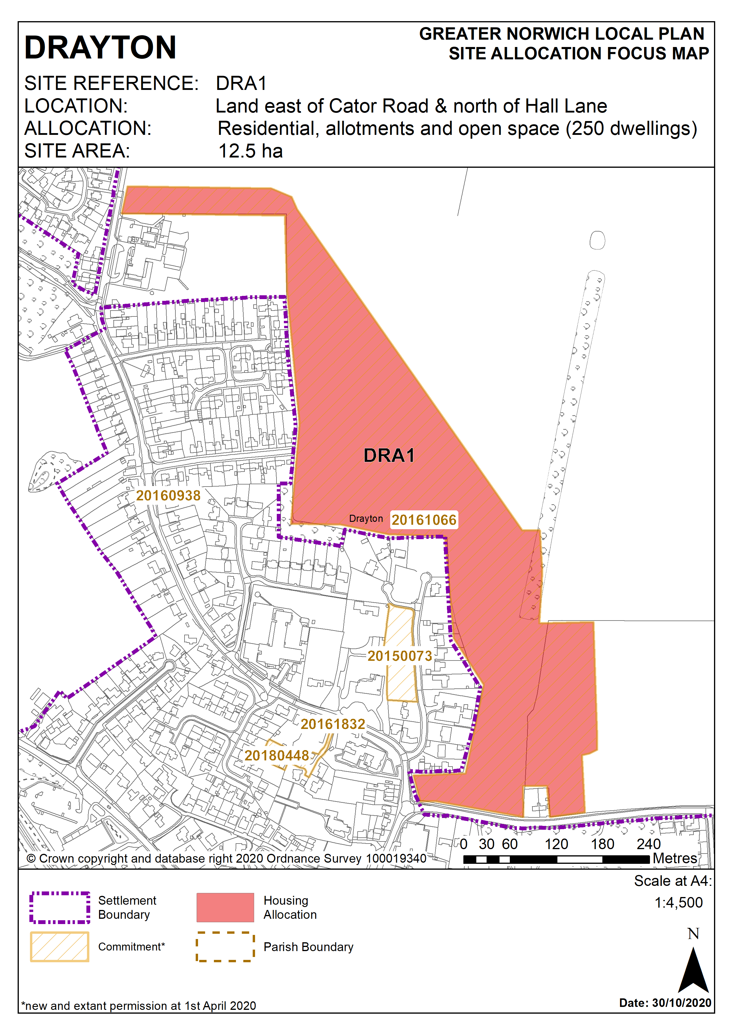
Policy DRA1
Land east of Cator Road and north of Hall Lane, Drayton (Approx. 12.5 ha) is allocated for residential development, allotments and open space. This will accommodate approximately 250 homes.
The development will be expected to address the following specific matters:
- Vehicular access to be achieved from Hall Lane and School Road.
- Appropriate surface water drainage proposal to mitigate risk of surface water flooding issues associated with this site.
- Green infrastructure linkages provided from the site to Hall Lane and Reepham Road via a network of footpaths to the side of School Road and also across the adjoining agricultural field to the north east of the site. A footpath/cycleway should also be included to the south side of Reepham Road from the junction with School Road to the roundabout at Drayton Lane.
- Provision of onsite public open space in accordance with relevant policy.
- Provision of allotments.
- Any development must conserve and enhance the significance of the grade II listed 4 Manor Farm Close including any contribution made to that significance by setting. This includes but is not limited to appropriate landscaping, setback and design.
Policy Map