2.89
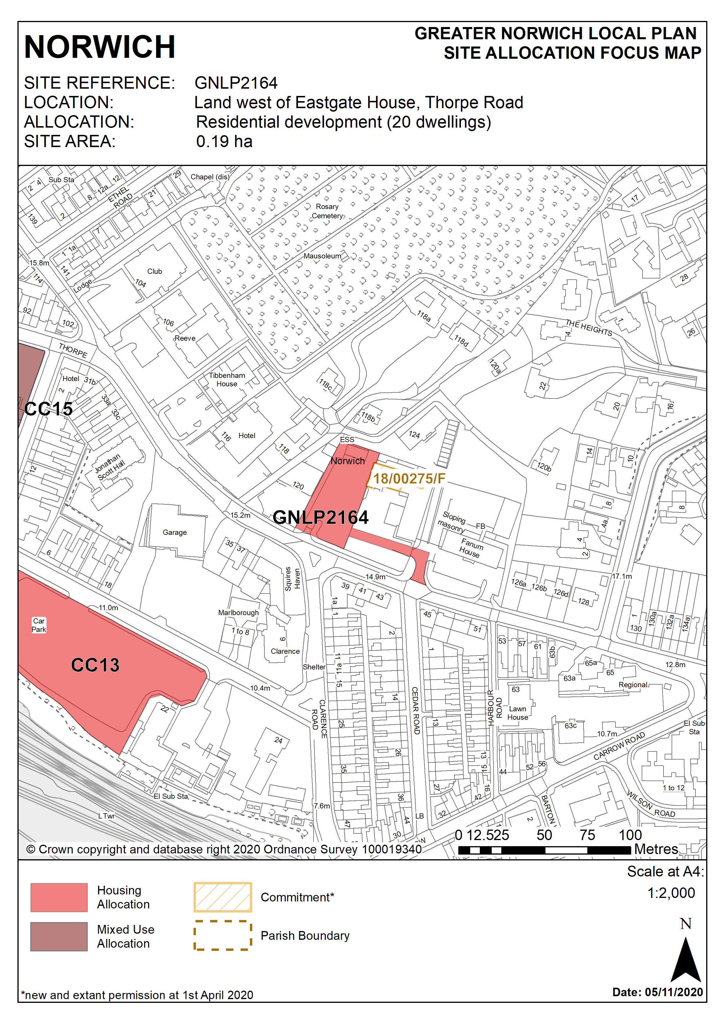
This 0.19ha site to the east of Norwich City Centre is currently occupied by a surface car park associated with Eastgate House accessed from Thorpe Road. It is bordered by recently converted Graphic House (from office to student accommodation) to the West, by employment and residential uses to the north, by recently converted (office to residential) Eastgate House to the east and by Thorpe Road to the South.
2.90
The site has a combined sewer within 100m of the southern boundary. Use of this asset in a drainage strategy for the site would be subject to permission from Anglian Water and therefore early consultation with Anglian Water is required. The site is in an area of Norwich with a significant number of internal and external flood incidences close by. This must be taken into consideration when designing a drainage strategy for the site and assessing surface water flood risk.
2.91
Development of the site must address a number of constraints including its location adjacent to the Thorpe Ridge Conservation Area, site ground conditions and its location adjacent to Rosary Cemetery registered parks & gardens and Lion Wood, Telegraph Plantation & Rosary Cemetery County Wildlife Site.
2.92
The site is expected to accommodate in the region of 20 homes. The site has been subject to previous outline proposals for residential development broadly in accordance with the allocation. Despite the refusal of a recent outline planning application in the absence of a mechanism to secure affordable housing, the principle of residential development is acceptable and has been supported.
Policy GNLP2164
Land west of Eastgate House, Thorpe Road (approx. 0.19 ha) is allocated for residential development. This will provide in the region of 20 homes.
The development will achieve the following site-specific requirements:
- Achievement of a high quality, locally distinctive and energy efficient design of a scale and form which is in keeping with the character of adjoining development, respects the heritage significance of the immediately adjoining Thorpe Ridge Conservation Area and protects the amenity and outlook of adjoining residential occupiers.
- High quality landscaping, planting and biodiversity enhancements including the provision of new trees and enhancing the green frontage to Thorpe Road.
- Ensures a high level of surface water flood resilience and incorporates appropriate flood mitigation measures addressing identified risks from surface water flooding which must be taken into consideration when designing a drainage strategy for the site;
- Low-car or car free development in accordance with Policy 2, is appropriate in this location.
Policy Map