2.107
The site was allocated in the previous Local Plan but has not yet been developed. The principle of development is already accepted, and it is expected that development will take place within the new local plan time-period up to 2038. The site is re-allocated for residential development. As an existing allocation it has been considered in the calculation of the housing requirement.
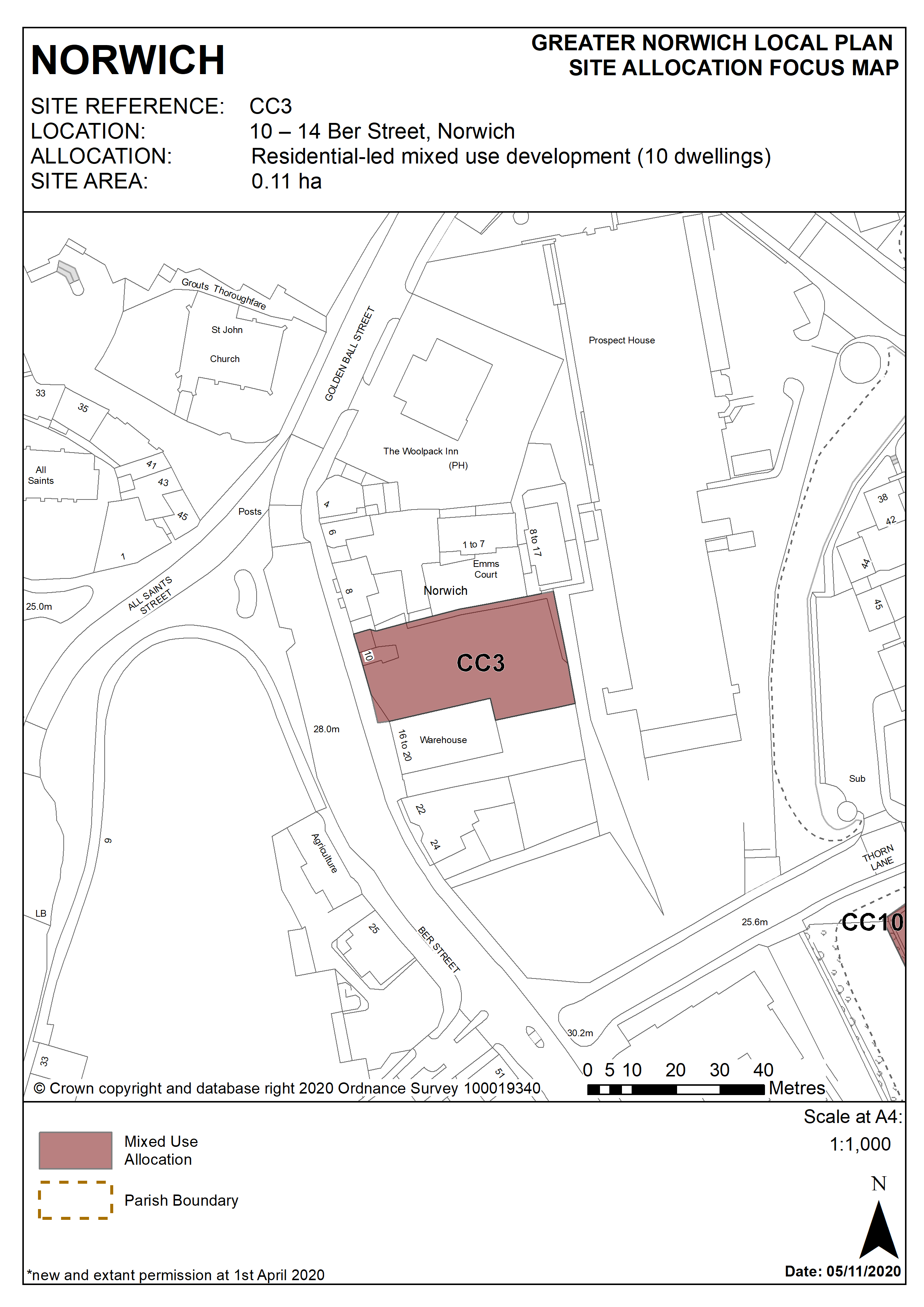
2.108
The site is 0.1 hectare in size and is located on the eastern side of Ber Street close to the junction with All Saints Green and Golden Ball Street. It comprises a vacant building at number 10 with the site of 12-14 adjacent, previously used as open storage land.
2.109
This site is on the fringe of the primary shopping area. It has an open, incoherent street frontage with a mix of building sizes and character. Number 10 is dated and of poor quality, and the site of number 12-14 comprises open storage land. The City centre conservation area appraisal identifies the buildings on the site as ‘negative buildings’, detracting from the character of the conservation area. There are a number of listed and locally listed buildings directly opposite the site on the west side of Ber Street.
2.110
Ber Street has been a major route out of the city since at least the 12th century, and is thought to have originally been a Roman road. Its use as a cattle drove to the old cattle market adjacent to the Castle is reflected in its unusual width. Today, following bomb damage during the Second World War and subsequent redevelopment, the street is fragmented in character, with remnants of its earlier character apparent but with much mid 20th century housing. The wider area is predominantly residential with some office development, and other commercial uses along Ber Street.
2.111
Development of the site must address a number of constraints including its location within the City Centre Conservation Area and the Area of Main Archaeological Interest, its location adjacent to listed buildings and possible contamination. The development of the site provides an opportunity to deliver a vibrant mixed use site fronting Ber Street, which will contribute positively to the character of the street, and will remove ‘negative’ buildings which currently detract from its streetscape and character.
2.112
The site is suitable for around 10 dwellings as part of a mixed use development, with some retail and/or office development along the Ber Street frontage. Development must enhance the setting of the neighbouring listed buildings and reflect its location in the City Centre Conservation Area. Its design must re-instate a strong building line along the street frontage, whilst respecting the area’s important topography and neighbouring uses.
2.113
The site is suitable for car free housing given its sustainable location and the provision of a car club space on Ber Street would be welcomed. An access across the site to the development to the rear of 6-8 Ber Street is required and any entrance point onto Ber Street should be located towards the southern boundary of the site.
2.114
An archaeological investigation will be required prior to development.
2.115
The site is served by an off-site combined foul and surface water sewer [northwest]. Adoption of this facility into a proposed drainage strategy must be pre-agreed with the appropriate management company.
Policy CC3
10 – 14 Ber Street, Norwich (approx. 0.11 ha) is allocated for residential-led mixed use development. This will accommodate a minimum of 10 homes.
The development will achieve the following site-specific requirements:
- Achievement of a high quality, locally distinctive design of a scale and form which respects its context including the topography of the area;
- Strengthen the building line along Ber Street and the scale of any new development should reflect that of the neighbouring properties.
- Conserve and enhance the significance of the City Centre Conservation Area and nearby locally and statutory listed buildings (including any contribution made to their significance by setting)
- Retail or complementary uses in use class E (b,c,g(i)) at ground floor level
- Residential uses (minimum of 10 homes) on the upper floors.
- The site is suitable for car-free housing given its sustainable location, in accordance with policy 2;
- An archaeological investigation will be required prior to development.
Policy Map