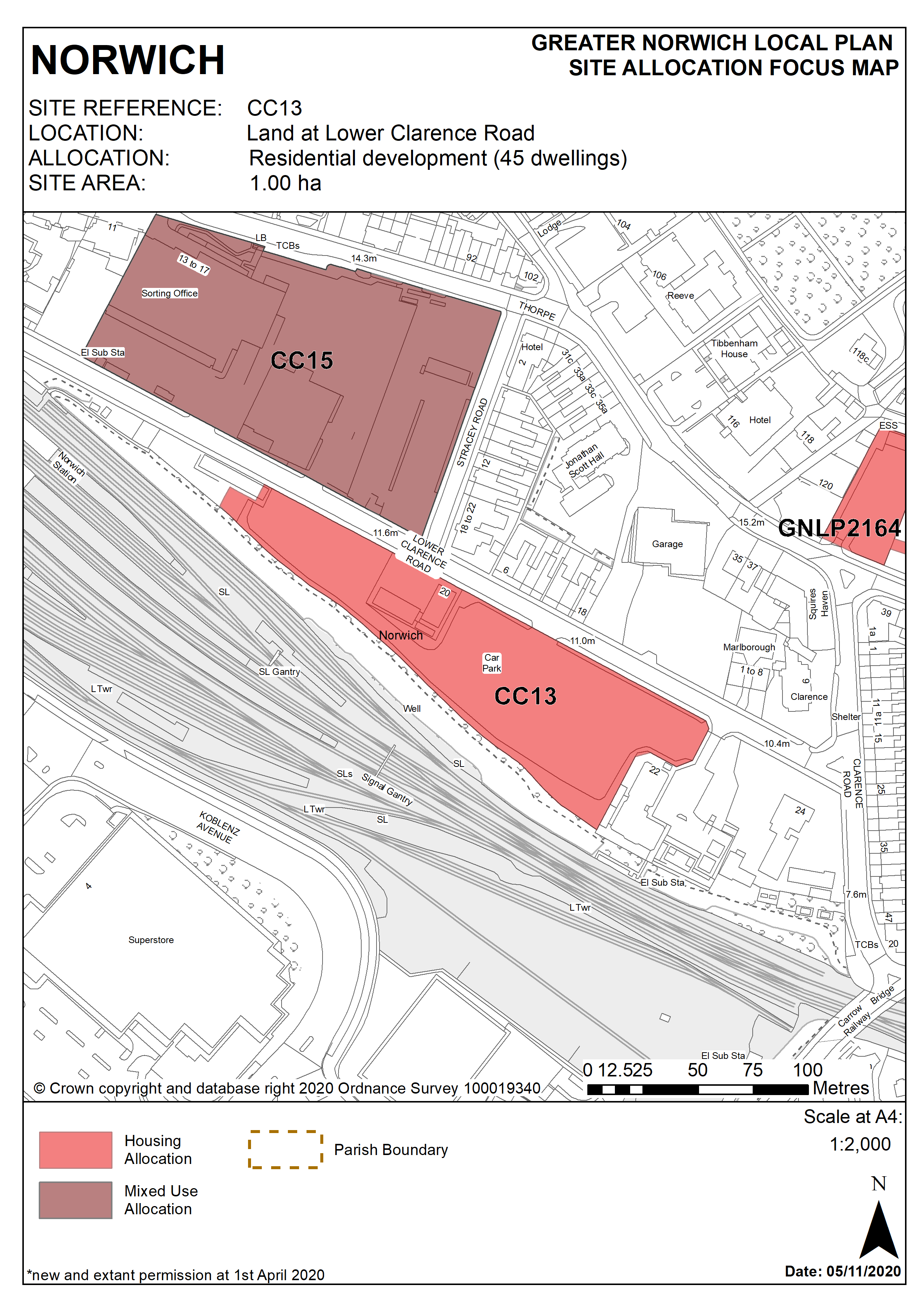
2.171
The site is located on the edge of the city centre and is 1 hectare in size. The majority of the site is currently used as a long-stay surface car park. A small part of the site is currently used by Network Rail’s maintenance delivery unit, with a two storey building and some temporary structures on site.
2.172
The site lies between the railway line and Lower Clarence Road and is within easy walking distance of Norwich train station. The vehicular entrance to Norwich Mail Centre is opposite the site on Lower Clarence Road. Also fronting the northern side of Lower Clarence Road is residential property extending to Stracey Road, with predominantly terraced houses. Norwich Mail Centre is identified for future development under policies CC15.
2.173
There is a steep slope to the southern edge of the site descending to the railway line. The site has good views towards the river and the conservation area beyond.
2.174
The site is close to a range of city centre facilities and the train station. It represents a good opportunity to provide housing development in a sustainable location.
2.175
Although the site is immediately adjacent to the railway line, in practical terms it is separated vertically by the slope on the southern boundary. Development of the site should address its constraints which include noise generated by the railway, and its topography.
2.176
The site is on the northern side of the river valley and development would be visible from a wide area and will affect the setting of the City Centre and potentially Bracondale Conservation Areas. It is also in close proximity to the St Matthews Conservation Area and the Thorpe Ridge Conservation Area. Therefore the design, including height and layout of the development, should take this into account. Given its accessible location car free housing is appropriate in this location.
2.177
Since the site is 1 hectare, a flood risk assessment is required and appropriate mitigation measures should be provided as part of the development.
2.178
In addition, given the site’s location adjacent to the railway, a noise assessment and appropriate mitigation measures will also be required.
2.179
Development needs to ensure that the water environment is protected throughout the development of the site. The site falls within Source Protection Zone 1, designated to protect water supplies, and therefore the water environment is particularly vulnerable in this location. Detailed discussions over this issue will be required with the Environment Agency to ensure that proposals are appropriate for the site and that the site is developed in a manner which protects the water environment.
2.180
The site was allocated in the previous Local Plan but has not yet been developed. The principle of development on the site has already been accepted, and it is expected that development will take place within the new local plan time-period up to 2038. The site is re-allocated for residential development.
2.181
The site is likely to accommodate at least 45 homes. More may be accommodated, subject to an acceptable design and layout etc. being achieved.
Policy CC13
Land at Lower Clarence Road (approx. 1.00ha) is allocated for residential development, for a minimum of 45 dwellings.
The development will achieve the following site-specific requirements:
- Achievement of a high quality, locally distinctive, energy efficient design whose form and massing takes account of and respects its location;
- Design of the development should take account of the topography of the site and any potential impact on the setting of nearby conservation areas. Height of development will be especially important given the elevated position of the site;
- Achieve high quality landscaping, planting, biodiversity and green infrastructure enhancements;
- A noise assessment is required and the development must be designed to mitigate the impact of noise from the railway.
Policy Map