6.46
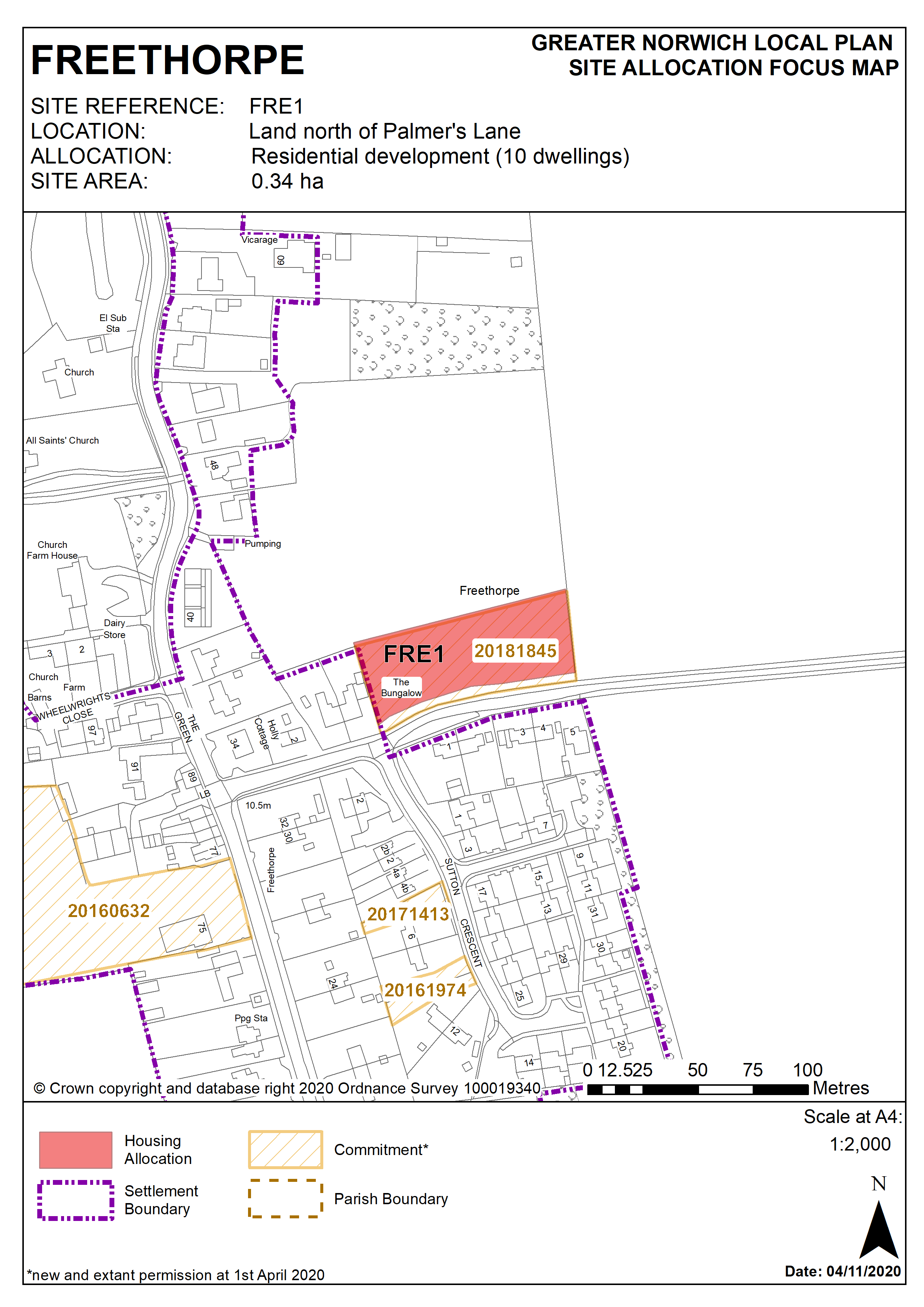
This site to the east of Gayford Road was allocated in the 2016 Broadland Local Plan but has yet to be developed at the base date of this plan, although planning consent has been granted for 5 dwellings (20181845). The principle of development on the site has already been accepted and it is expected that development will take place within the time-period of this local plan up to 2038. The site is considered in the calculation of the housing requirement, providing at least 10 homes, but more may be accommodated, subject to an acceptable design and layout being achieved.
6.47
This site is underlain by sand and gravel so Norfolk Minerals and Waste Core Strategy policy CS16 would apply if the site size is increased above 1 hectare.
Policy FRE1
Land north of Palmer's Lane, Freethorpe (approx. 0.34ha) is allocated for residential development. This will accommodate approximately 10 homes.
The development will be expected to address the following specific matters:
- Vehicular access must be demonstrated off Palmer's Lane.
- Other off-site improvements to the highway network will also be necessary, in particular to the junction of Palmer's Lane and The Green.
- Pollution control measures should be incorporated to mitigate harm to the water environment as the site is within the proximity of a Major Aquifer of high vulnerability.
- Any development must conserve and enhance the significance of the grade II listed Walpole Almshouses to the north west of the site, including any contribution made to that significance by setting. This includes but is not limited to landscaping along the northern boundary of the site.
Policy Map