5.41
The combined settlement of Loddon and Chedgrave is identified as a key service centre under policy 7.3. There is a range of services including shops, infant, junior and high schools, medical centre, library, public houses and industrial estate. The settlement is well served by buses linking to Norwich, Beccles and Lowestoft, and a development of 200 homes north of George Lane, Loddon is currently being progressed.
5.42
Issues taken into account when assessing the potential for future development include a substantial Conservation Area covering the town centre of Loddon and extending into Chedgrave, plus a separate Conservation Area around the Church of All Saints. The town centre is characterised by closely built up streets, interspersed with important open spaces, such as Church Plain. The Broads Authority area extends into the town centre, along the valley of the River Chet. The A146 bypass defines the extent of the settlement to the south and west, with the river valley that separates Low and High Bungay Road from the development off Beccles Road providing a noticeable green break.
5.43
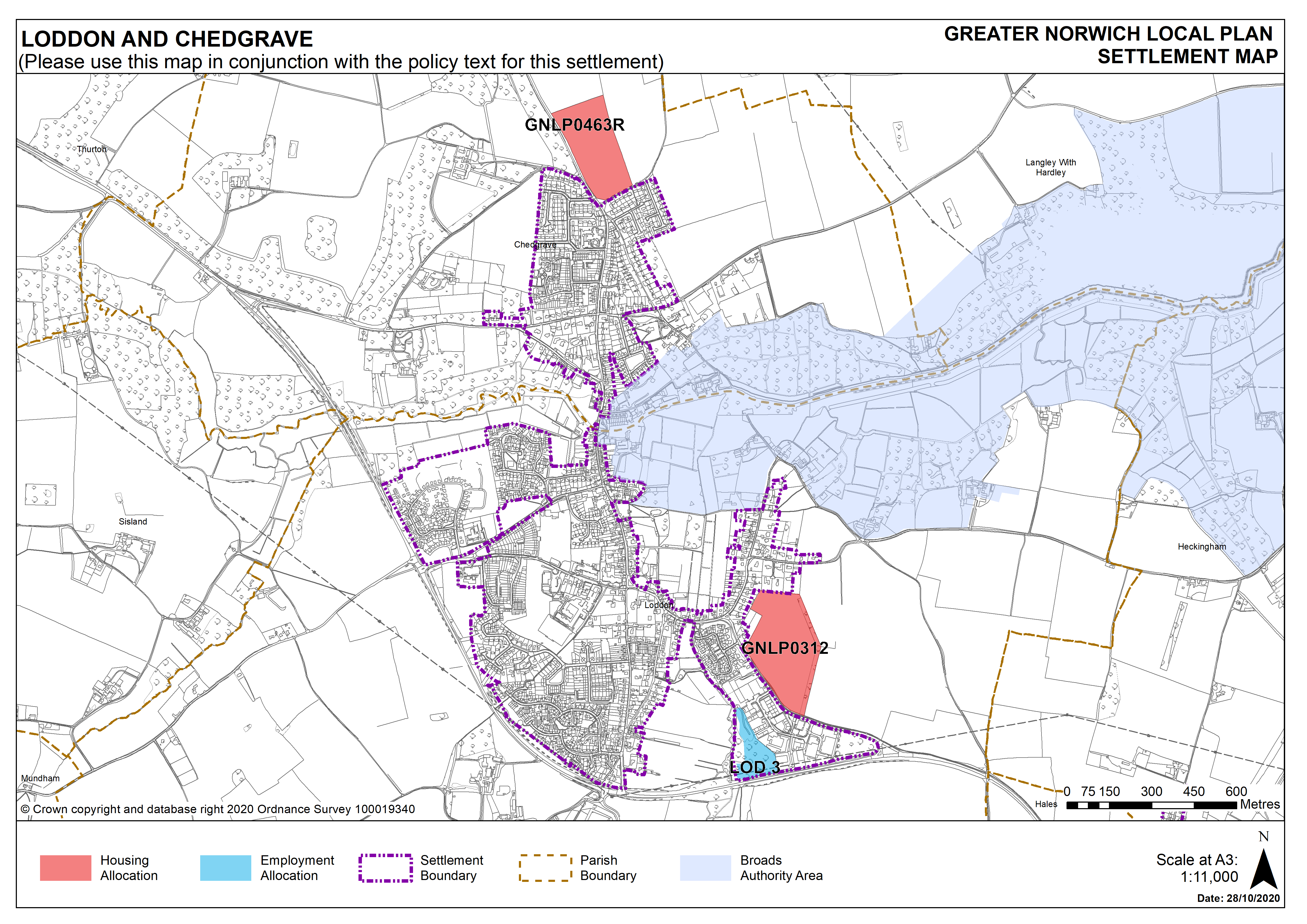
Two sites are allocated providing for at least 240 new homes in the key service centre (one for 180 homes, one for 60 homes). There are no carried forward residential allocations and a total of 206 additional dwellings with planning permission. This gives a total deliverable housing commitment for Loddon and Chedgrave of 446 homes between 2018 – 2038.
5.44
All new and carried forward allocations are expected to address standard requirements associated with development. These vary from place to place but are likely to include mitigations for flood risk (as well as SUDs), highways improvements, safeguarding of minerals resources, land remediation, measures to protect the environment, biodiversity, and landscape intrusion.
Settlement Map