5.14
This site was allocated in 2016 as part of the Broadland Local Plan but has not yet been developed. The principle of development on the site has already been accepted and it is expected that development will take place within the time-period of the new local plan up to 2038. The site has been the subject of several permissions. It is likely to accommodate up to 175 homes reflecting planning permission 20160488; a supermarket and restaurant reflecting permission 20140758; and 2,500sqm of employment floorspace reflecting permission 20160497.
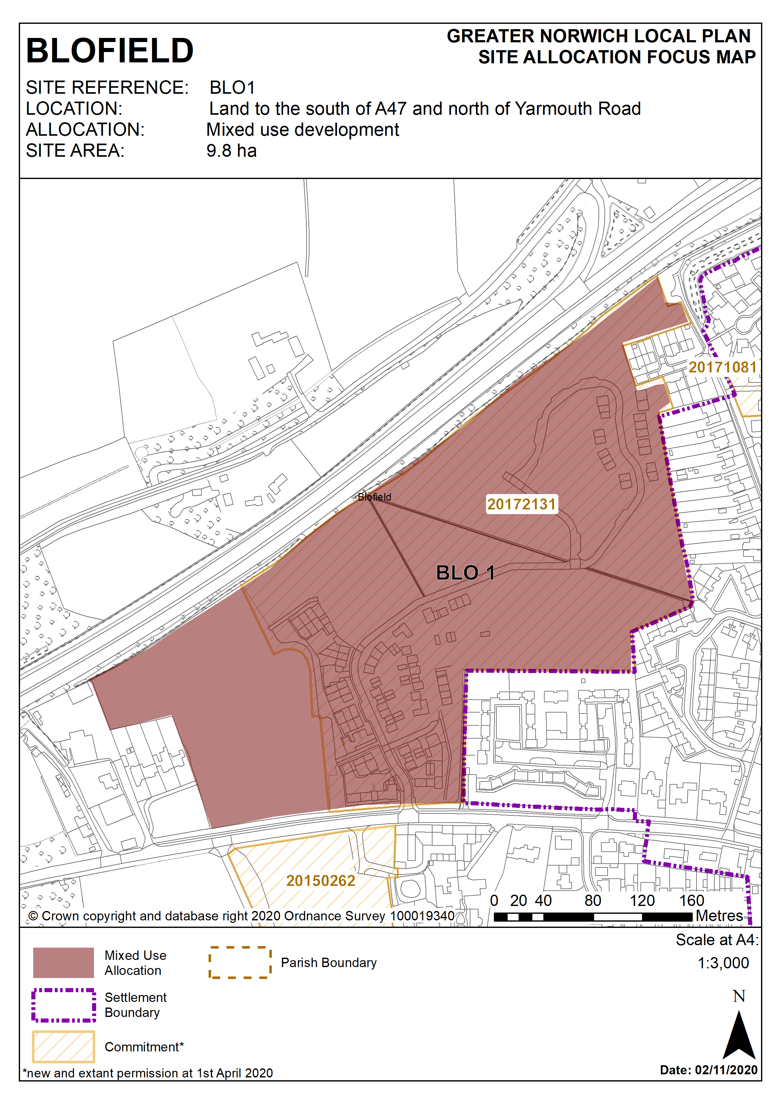
Policy BLO1
Land to the south of A47 and north of Yarmouth Road, Blofield (approx. 9.8 ha) is to be developed in accordance with planning permissions 20140758 and 20160488. This will include a mixed- use development to deliver 175 dwellings, a maximum floor space of 4,000 sqm E(g) use class and open space.
More homes may be accommodated, subject to an acceptable design and layout, as well as infrastructure constraints.
The development will be expected to address the following specific matters:
- Vehicular access to be achieved from Yarmouth Road.
- Any development must conserve and enhance the significance of Manor Farm Barn to the south of the site, including any contribution made to that significance by setting.
- On site public open space to be provided.
- Provision of allotments.
- Avoid contamination of groundwater.
Policy Map