2.305
The site was allocated in the previous Local Plan and has been subject to planning permission for a development of 17 homes which has not been implemented. The principle of development on the site has already been accepted, and it is expected that development will take place within the new local plan time-period up to 2038. The site is re-allocated for residential development providing a comparable number of homes to the approved scheme. As an existing allocation with valid permission at the base date of the plan it has been considered in the calculation of the housing requirement.
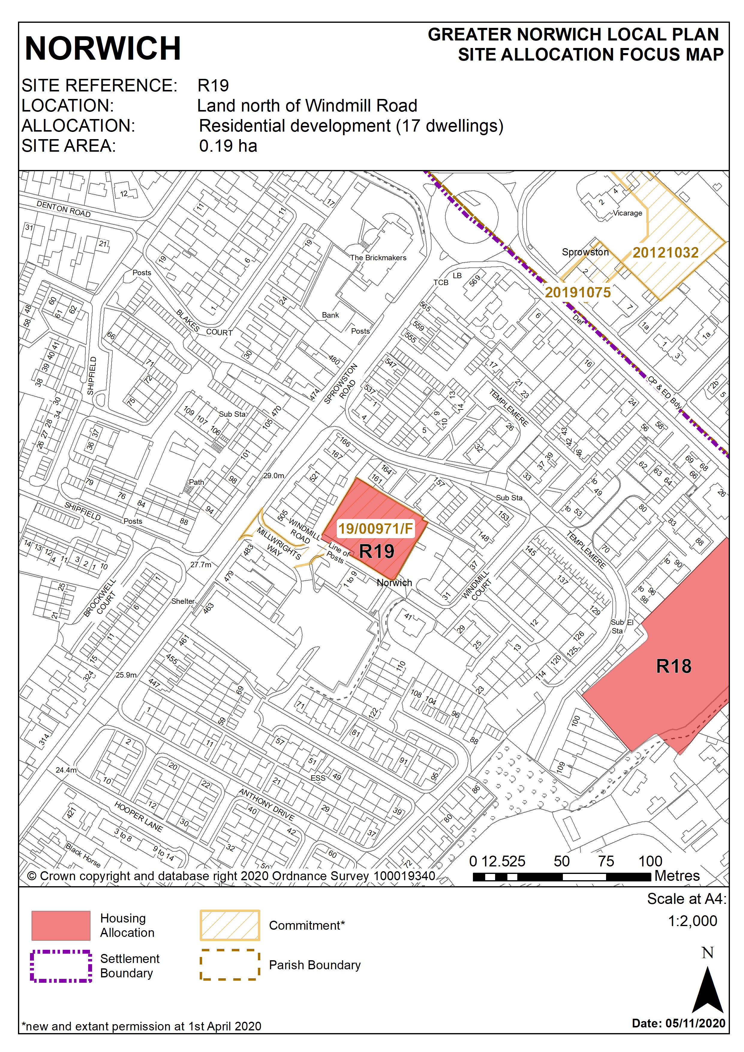
2.306
The site is in the north of the city and is 0.18 hectares in size. Windmill Road links Sprowston Road and Templemere via a privately owned and unsurfaced track.
2.307
The site is surrounded by housing which is a mixture of 2 storey semi- detached housing and Victorian terraces. There are 3 storey flats adjacent to the north of the site. The site is in close proximity to the Sprowston Road/Shipfield local centre.
2.308
The site is close to a district centre with excellent public transport links. The mixed use development to the south of Windmill Road has recently seen completion of a foodstore and a small number of housing units.
2.309
The recent development of a foodstore on the adjacent site has enlarged and strengthened the Sprowston Road/Shipfield neighbourhood shopping centre and enabled its reclassification from a local to a district centre, so that it can better meet the area’s day to day needs for top-up shopping. Housing development will additionally aid regeneration and will benefit from its location close to the centre and the excellent public transport links.
2.310
Development proposals must address the site’s constraints. These include undertaking ground conditions and contamination surveys and an archaeological assessment.
2.311
The design of the development must take account of the differing land levels within the site, its sloping nature and on site trees.
2.312
Sprowston Road is part of the major road network and is a core bus route. A new access to Sprowston Road has been provided as a result of the implemented permission on the adjacent site. Linking into this new access would enable Windmill Road to be retained as an un-surfaced track offering pedestrian and cycle friendly links to Anthony Drive and Templemere.
2.313
Assessment and protection of on-site trees will be required followed by a scheme of landscaping to enhance site linkages.
2.314
The site lies within a Critical Drainage Catchment. Therefore development proposals involving new buildings, extensions and additional areas of hard surfacing should ensure that adequate and appropriate consideration has been given to mitigating surface water flooding.
2.315
The site is likely to accommodate in the region of 17 homes.
Policy R19
Land north of Windmill Road, Norwich (approx. 0.19ha) is allocated for residential development. This will accommodate in the region of 17 homes.
The development will achieve the following site-specific requirements:
- Achievement of a high quality, locally distinctive design.
- Design to take account of differences in level between the site and adjoining residential properties and effectively addresses potential issues of overlooking loss of privacy and surface water flooding;
- Vehicular access to the site should be taken from the south via Millwright’s Way, with pedestrian access retained via Windmill Road and links to Windmill Court and Templemere retained and enhanced
- Protection and enhancement of key green infrastructure, biodiversity and geodiversity assets within the site including replacement of trees on site, addressing the impact of adjacent trees on the site, and provision of a high-quality landscaping scheme.
Policy Map